Category: Bicycling U.S. Civil War Battlefields

  • Our Shop Got a Makeover! Get a FREE map.

    Our Shop Got a Makeover! Get a FREE map.

    Civil War Cycling’s online shop has been redesigned so that we can easily offer discounts and sales. Just point your web browser to civilwarcycling.com and click the SHOP menu option. Or go directly here: civilwarcycling.com/shop/. Help test our new shop and get a free map!

    THIS OFFER EXPIRES NOVEMBER 20, 2020
    or when all twenty (20) PROMO CODES are claimed, whichever comes first
    .

    Help test Promo Codes and get this FREE map:

    PDF document map for a 9.2-mile historical bike tour through Antietam National Battlefield, “Bike Antietam Route 1 Map”

    Learn Civil War history on two wheels at Antietam National Battlefield in Sharpsburg, Maryland. This is a 34-page full color, printable PDF map (not GPS navigation) with photos, bicycling cues, and tips for a 9.2-mile historical tour. 

    Antietam Route 1 Bike Map

    No passwords or license keys! You will receive an email with a download link after completing the checkout process. Print or view on your PDF-enabled mobile device or desktop computer. (You need Adobe’s free PDF reader).

    Please note: This PDF map supplements my recently published paperback guidebook (Bicycling Antietam National Battlefield: The Cyclist’s Civil War Travel Guide). The map is not the guidebook itself, available on Amazon (paid link).

    Exclusive Offer for Subscribers Only

    If you received an email directly from Civil War Cycling about this blog post, then at some point or another, you signed up to be a subscriber, so you are all set.

    RESTRICTIONS APPLY:

    1. Be a Civil War Cycling email subscriber.
    2. Use this NEW shop link: civilwarcycling.com/shop/
    3. Note that this offer is limited to the first twenty (20) people who successfully use the PROMO CODE to get a FREE downloadable copy of “Bike Antietam Route 1 Map (9.2 miles, pdf)”
    4. Offer expires on on 11/20/20 or when all PROMO CODES are used (whichever is sooner).

    If anything goes wrong with your shopping cart experience, you can trust me to fix it. I’m not looking to cause anyone any aggravation! Contact support@civilwarcycling.com anytime.


    It’s Easy! But here is some click-by-click help:

    To get your FREE map:

    Step 1. Click here: civilwarcycling.com/shop/

    Step 2. Scroll down to find this map:

    “Bike Antietam Route 1 Map (9.2 miles, pdf)” $5.95

    Ignore the $5.95 price. Your discount code will zero that out.

    Ignore the “Pay Using PayPal” banner. Your discount code will change that to “Free Checkout.”

    Step 3. Click “Add to Cart”

    What if you change your mind and want to stop? Close your checkout window to abandon your cart; or click “Remove” and “Continue Shopping.”

    Oh, and guess what?! A BONUS

    If you want one or both of the maps for a biking excursion to Antietam from the C&O Canal Towpath, you can add these PDFs to your cart as well (also FREE today):

    “C&O Canal Route 2, South to Antietam Map (pdf)” $5.95 (FREE with code)

    “C&O Canal Route 3, North to Antietam Map (pdf)” $5.95 (FREE with code)

    What if you want FREE maps for an Antietam excursion from the C&O Canal Towpath? Then click “Continue Shopping,” find the map, click “Add to Cart.” Do that for both maps, if you want. Woa! The price total could add-up to $17.85 USD. To zero that out, proceed to Step 4 to add your PROMO CODE.

    Step 4. Click “ADD PROMO CODE”

    Enter Promo Code: makeover2020

    What if your discount code is rejected? Abandon your cart. Please do NOT pay. Contact me at support@civilwarcycling.com and describe what happened. I cannot make 1,000 exceptions—BUT if, for example, you are customer #21 and the only person whose code got rejected, gosh, I’m certainly going to fix that for you.

    And Remember: This promo code will only work for the Antietam and C&O Canal excursion maps. If you want to buy any Gettysburg maps in this same transaction, that should be possible to do.

    Step 5. Click “Apply”

    You will notice a slight delay as your screen refreshes.

    If you only added the Antietam and C&O Canal maps, then you should see that your Total is 0.00 USD.

    What if you accidentally added maps that are not part of this discount offer? Click to “Remove” those products from your shopping cart. Or if you decide to buy those maps, click “Pay Using PayPal” and use PayPal’s screens for payment by credit card, debit card, or PayPal account—and of course, skip all of the the “Free Checkout” steps below.

    Step 6. Click “Free Checkout”

    Again, your checkout will be FREE only if you meet the terms of this offer, which I describe above. Do not pay for anything that you do not want to pay for!

    Step 7. Enter Your Email and Name

    Civil War Cycling needs your email address so that we can email you a download link to the PDF map. (You will get one email per product that you ordered). You can read more about Civil War Cycling’s Privacy Policy, here.

    Step 8. Click “FREE CHECKOUT”

    Watch the wheel spin and then you will see an order confirmation that has a green Download button. Don’t click that button yet. Read on…

    If you are using your phone, it is probably best not to click Download, because Civil War Cycling’s PDF maps are very large (and have you installed Adobe PDF Reader on your phone?).

    Instead, I recommend that you check your email from a desktop computer (or whatever device or computer with which you read PDF files). There’s no rush. You have up to 5 days to download the file before the download link expires. Just click the download link in the email that you receive.

    Step 9. Check your email. Download your FREE map.

    You will a Thank You email with an Invoice ID and link to your order details. You will also receive one email per PDF map in your shopping cart—that is where you will find the download link to get your PDF map.

    You will need Adobe’s free PDF Reader to view or print the PDF.


    Thank you!

    Questions or problems? I will make things right. support@civilwarcycling.com

  • Ten Tips for Biking Gettysburg Battlefield

    Ten Tips for Biking Gettysburg Battlefield

    These ten tips for biking Gettysburg are a reprint of an article that I wrote for John Bank’s Civil War Blog on October 26, 2018. Today, I am reposting the article, because Fall is an excellent time to bike Gettysburg, and this weekend promises unusually warm and sunny weather. I guarantee you, cyclists and hikers will be out enjoying the battlefield this weekend. So here we go, ten tips for biking Gettysburg…

    Ten Tips for Biking Gettysburg

    “There’s no better way to tour Gettysburg National Military Park than on a bike!” I hear that a lot. For people who love outdoor, experiential learning, it’s a no-brainer. … My name is Sue, and here’s a shot of my bike pedaling up the crest of Devil’s Den:

    tips  for biking Gettysburg
    10 Gettysburg cycling tips for adventurous learners — It’s not hard to imagine what this ride up Devil’s Den will teach you about the Battle of Gettysburg.

    In the above photo, you can see Little Round Top on the right and the cannons of the 4th New York Independent Battery straight ahead. I am riding under the bough of an oak “witness tree,” so-called because the tree is old enough to have “witnessed” the Battle of Gettysburg. On a bike, your senses are bombarded with picture-perfect scenery, smells of grass, sounds of chatter (and silence), and even the salty taste of sweat. For history buffs, the battlefield is an outdoor classroom that provides an exciting opportunity to learn—on your timetable, your way. Like a kid.

    Here are ten tips for biking Gettysburg—all examples of learning by doing:

    #1. Ride through Rose Woods

    Rose Woods is an ideal cycling experience, partly because this area is not on the official National Park Service (NPS) auto tour. That means no busses and less cars.  Find a good park map, because the ride through Rose Woods has lots of twists and turns, and at least one confusing intersection. Brace yourself for a hilly ride through a heavily wooded area lined with many regimental monuments. If you make it up the short but steep incline that ends at the 2nd Delaware Infantry Monument (below), you will enjoy a fast glide down to The Wheatfield.

    tips  for biking Gettysburg, know your geography
    View from Little Round Top, looking southwest.

    For a historical introduction to the fighting here on July 2, 1863, I hope that you enjoy this video (4:24) of a ride through Rose Woods. It’s one of my first experiments using a GoPro video camera to record a ride along with historical commentary. (Yep, amateur).

    #2. Try to spot monument symbols…

    And connect them to the Army of the Potomac’s seven Union corps that fought at the Battle of Gettysburg:

    • full moon (circle) = 1st Corps (Reynolds)
    • trefoil (clover) = 2nd Corps (Hancock)
    • diamond = 3rd Corps (Sickles)
    • Maltese cross = 5th Corps (Sykes)
    • simple cross = 6th corps (Sedgwick)
    • crescent moon = 11th Corps (Howard)
    • star = 12th corps (Slocum)
    2nd delaware monument
    2nd Delaware Infantry Monument

    But why?! Because if you want to learn the battlefield military story, the monuments give helpful visual clues about what corps fought where. (Read about it here). For example, notice the clover on the top of the 2nd Delaware Infantry Monument in Rose Woods. (It’s not a coincidence that this monument is on Brooke Avenue, a park road named for Union Col. John R. Brooke, the brigade commander for the 2nd Delaware regiment).

    #3. Collect “themed” photos on your ride

    In other words, pick a topical area and then hunt for and photograph the monuments that fit that topic. Here are some examples (all of which are documented in my book, Bicycling Gettysburg National Military Park, March 2019):

    Then try to figure out the meaning behind each monument’s placement and history. The George G. Meade (USA) and Robert E. Lee (CSA) Equestrian Monuments, for example, each face the other, just as their two armies squared off with each other on July 2-3, 1863, across a one-mile wide field.

    Gen. Meade Equestrian Monument on Cemetery Ridge
    Union Maj. Gen. George G. Meade Equestrian Monument, Cemetery Ridge.
    Gen. Robert E. Lee Equestrian Monument on Seminary Ridge
    Gen. Robert E. Lee Equestrian Monument, Seminary Ridge.

    #4. Find your favorite state monument

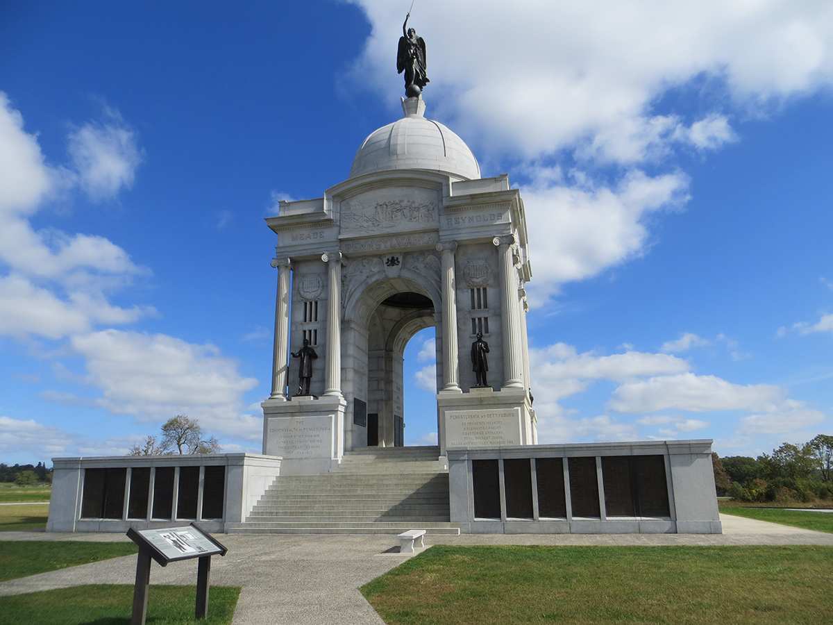
    Find your favorite state monument (USA, CSA) – And don’t miss the ride down the entire length of West Confederate Avenue, because it’s on that straight-away that you will find the North Carolina, Tennessee, Virginia, Florida, Louisiana, Georgia, South Carolina, Arkansas, Texas, and Alabama state monuments—in that order, from north to south. Union state monuments are on Cemetery Ridge and Cemetery and Culps Hills.

    #5. Where does that cannon point?

    The roughly 400 cannons at Gettysburg are positioned for historical accuracy. So, pick a cannon and peer down its barrel to where it points. In the next photograph, for example, you might want to research Confederate Brig. Gen. Ambrose R. Wright’s (Georgia Brigade) attack through the Codori farm to Union positions protected by this rifled cannon on July 2, 1863.

    Union view from Cemetery Ridge, Gettysburg
    Union cannon on Cemetery Ridge facing the Codori Barn and Seminary Ridge

    #6. Connect physical and natural structures to battlefield maps

    If your maps identify Gettysburg barns, observation towers, ridges, roadways, and tall monuments, you can use these maps to get and stay oriented on the battlefield. That’s no small feat on 6,000 acres of park land. (Click here for a “how to” example. Or, for a more interactive approach, click here.)

    distant view of Seminary Ridge
    Looking west from the Copse of Trees on Cemetery Ridge. The Virginia State Monument is visible in the distance.
    fields of Pickett's Charge
    Looking east near the Virginia State Monument. Can you spot Meade’s Equestrian Monument (left side of the fence, in the distance), the tree at The Angle (right side of the fence), The Copse of Trees (right of The Angle)?
    tips for biking Gettysburg, use a map!
    With a good set of maps, you can use Gettysburg’s barns, ridges, roads, and tall historic monuments to stay oriented on the battlefield.

    #7. Ride down Culp’s Hill

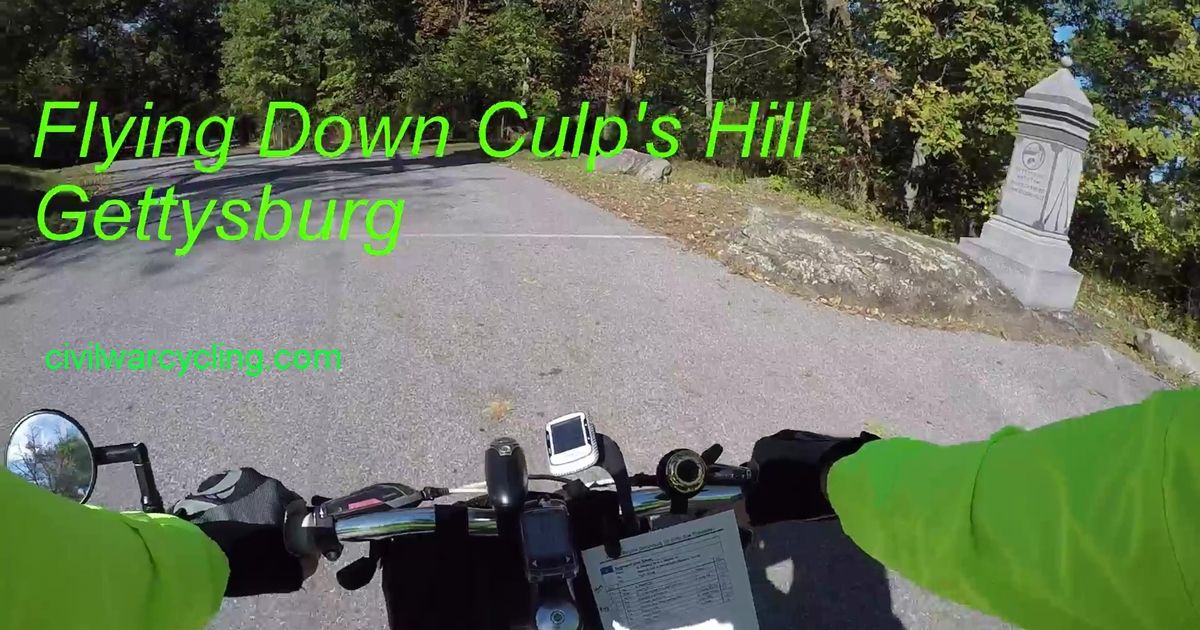
    After a 1-mile climb to the top of Culp’s Hill, who wouldn’t enjoy “flying” down to Stevens’ Knoll? Here’s a video clip of one ride down: Flying Down Culp’s Hill, Video (1:10)

    #8. Make your own scavenger hunt

    Before your trip, make a list of things that you want to find. Here are some examples to get your thinking juices flowing (you can enter GPS coordinates into the Google Maps search field):

    • Witness Trees (click here for GPS coordinates for seventeen trees)
    • Monument sculptures that include dogs (39.84222, -77.24256; 39.79703, -77.24511)
    • Dinosaur footprint (39.78479, -77.24475)
    dinosaur footprint
    200-million-year-old dinosaur footprint

    You will find this dinosaur footprint on a stone bridge over Plum Run, South Confederate Avenue, on the south side of the road.

    #9. Know the “secret” meaning of the park roads!

    Did you know that most of Gettysburg’s park roads are named after Union officers, and that the shape of these roads roughly matches the officers’ most significant battle lines? Simply by reading park road signs, bicyclists can learn basic battlefield formations without the drudgery of rote memorization.

    #10. Park you bicycle and visit Soldiers’ National Cemetery

    Read the Gettysburg address on the bronze plaques of the Lincoln Address Memorial, visit the Honey Locust Witness Tree (39.81788,-77.23152), find the grave of Sgt. Amos Humiston (154th New York), or enjoy a quiet circular stroll among labeled species of native trees.

    Ten Tips for Biking Gettysburg, Wrap-Up

    Over the decades, I have toured the battlefield many dozens of times—on foot, by car, by bus—and since 2012, by bicycle across all four seasons. I learn something new everytime. I look forward to hearing about your learning adventures cycling Gettysburg National Military Park. Take a ride back in time … On A Bike.

  • Gettysburg State Monuments Sample Chapter

    Gettysburg State Monuments Sample Chapter

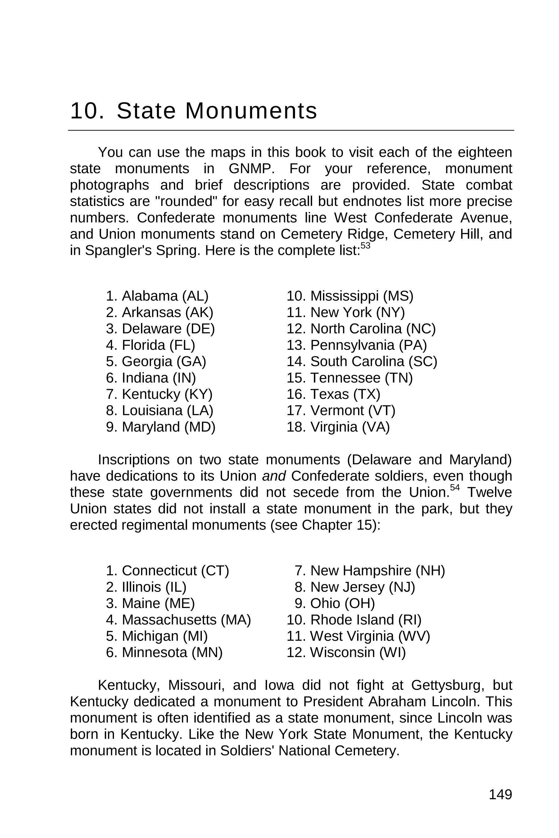
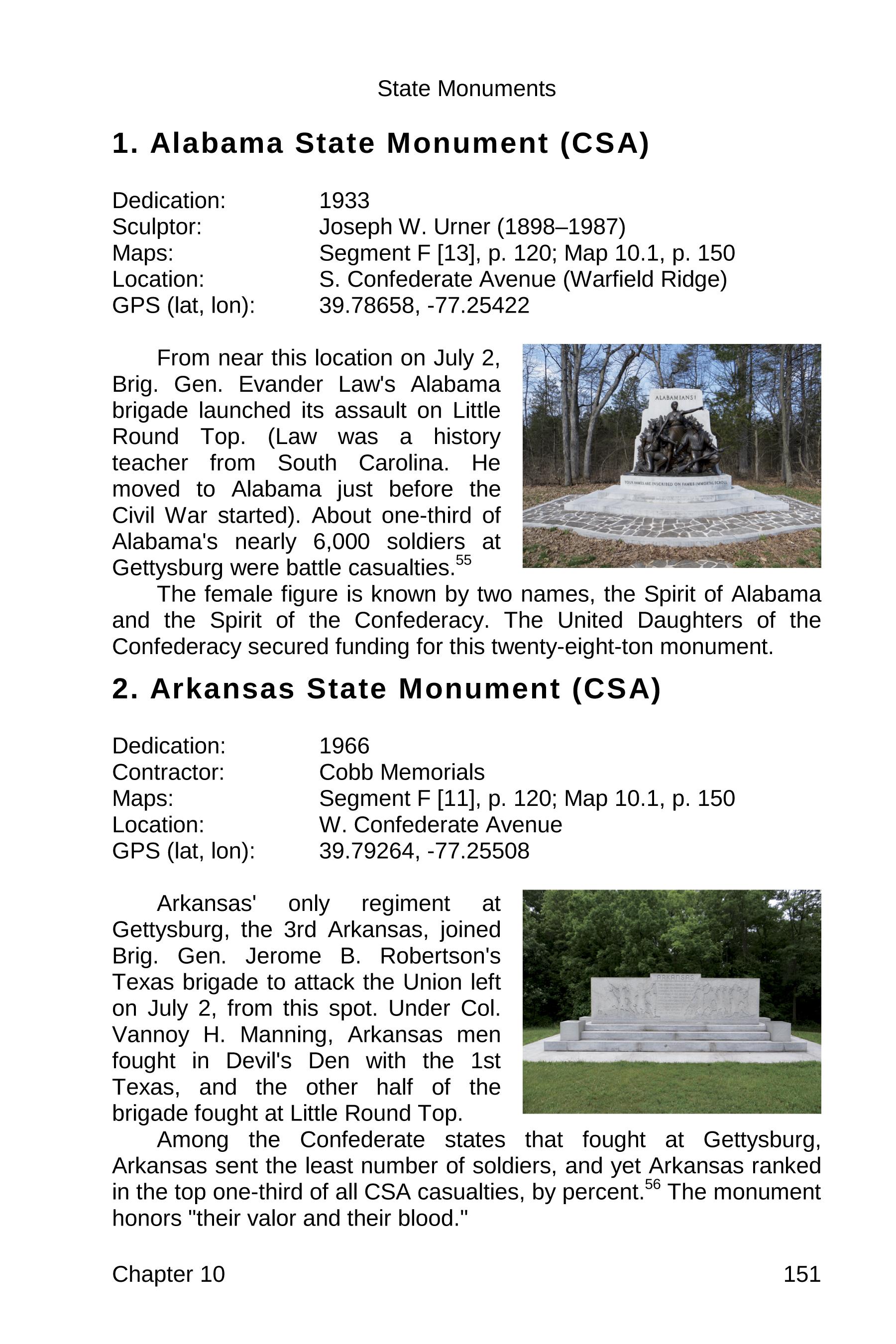
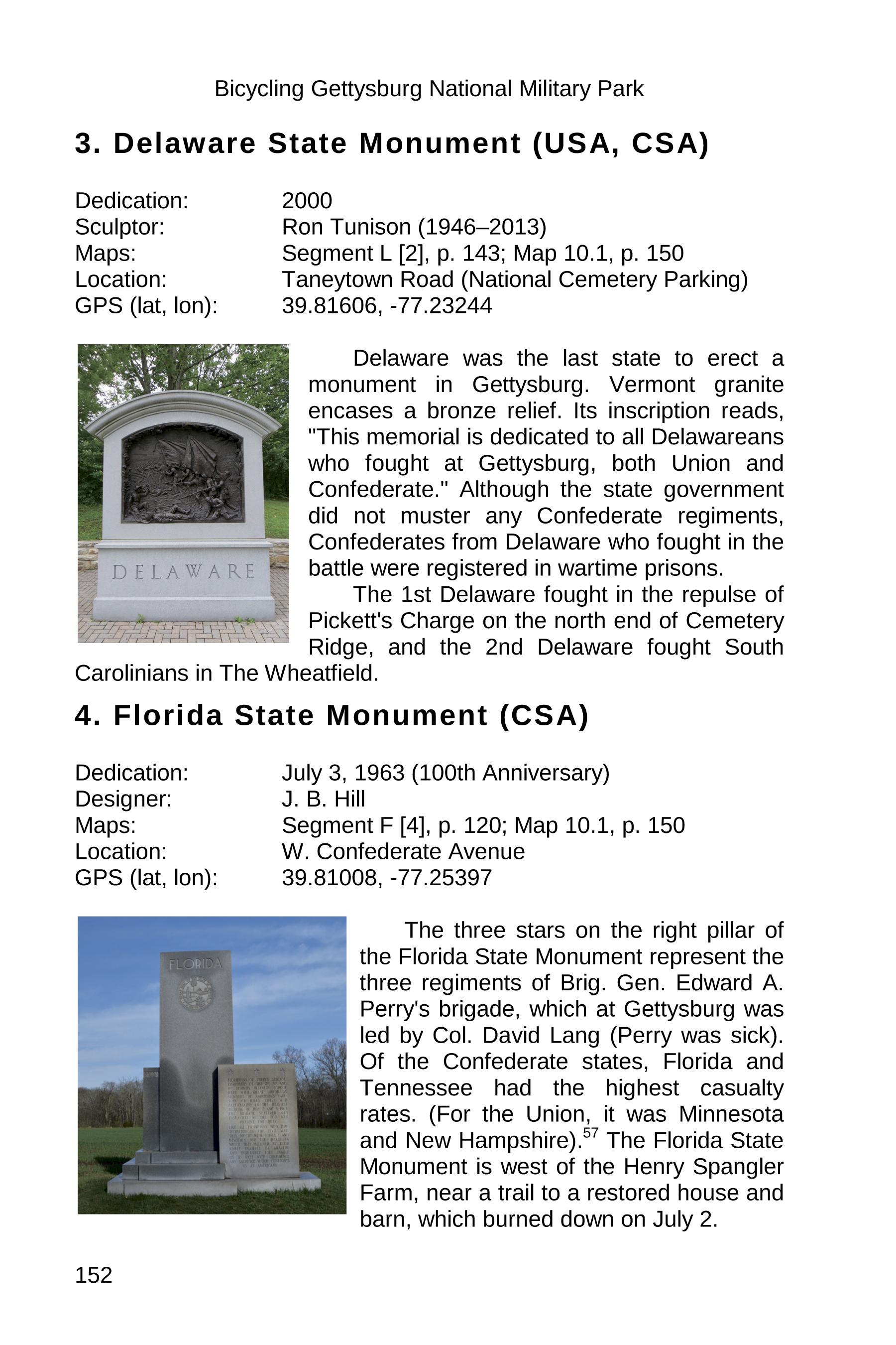
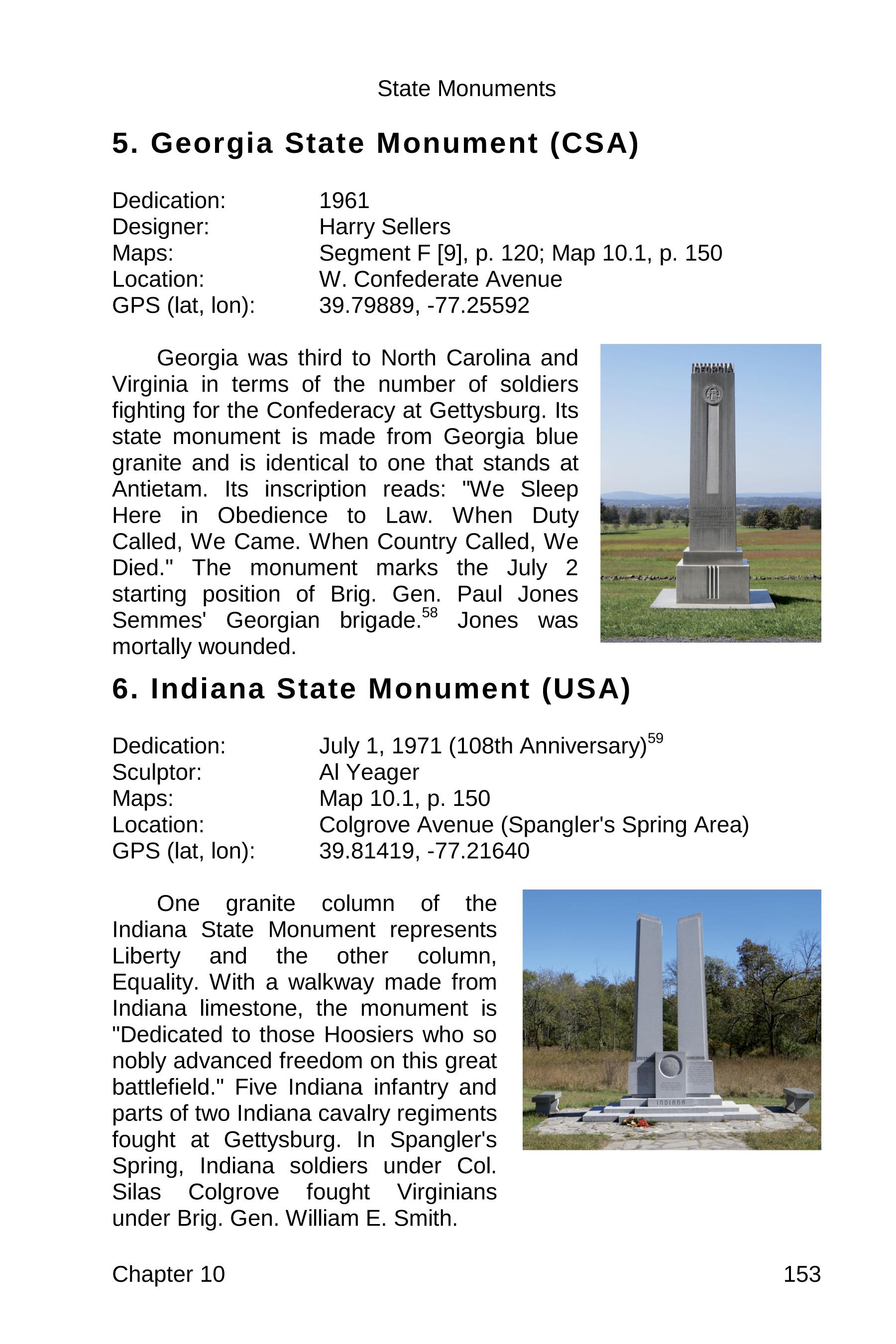
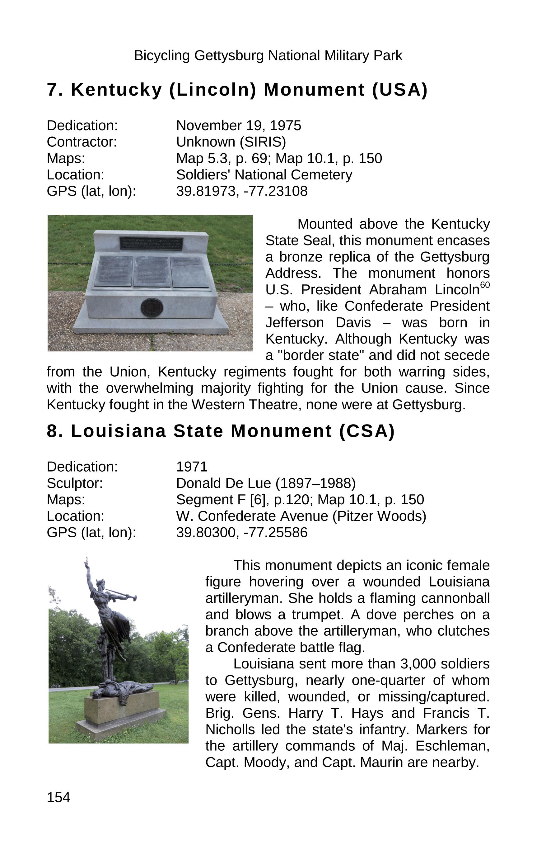
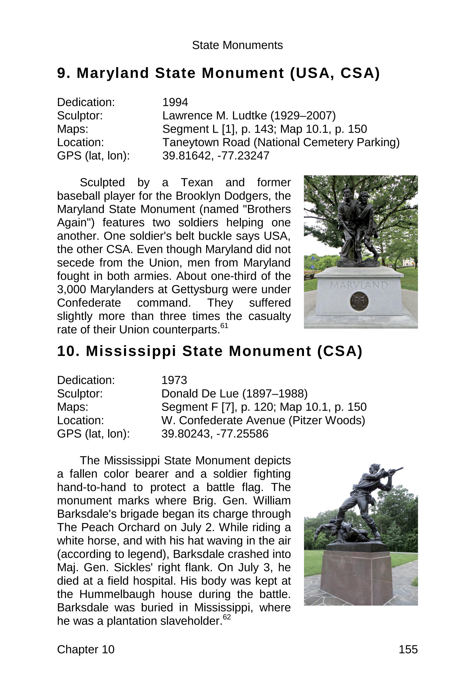
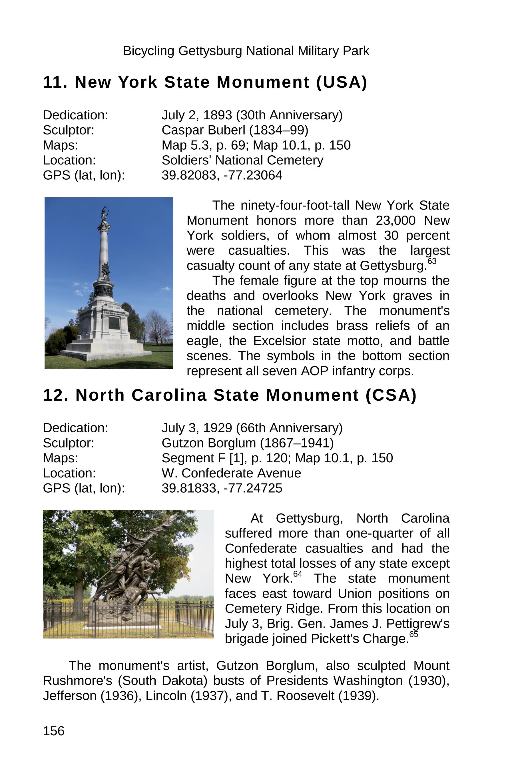
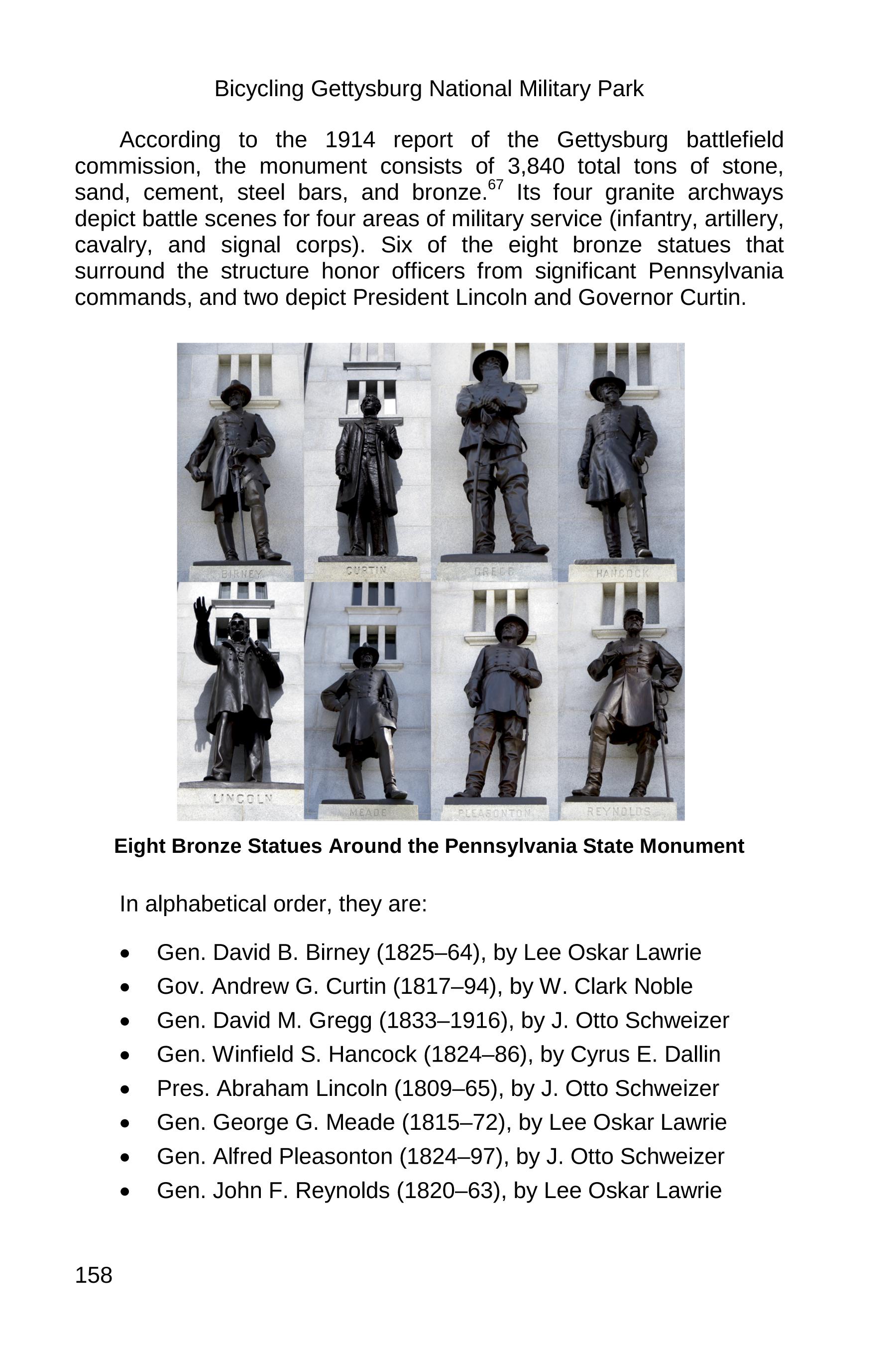
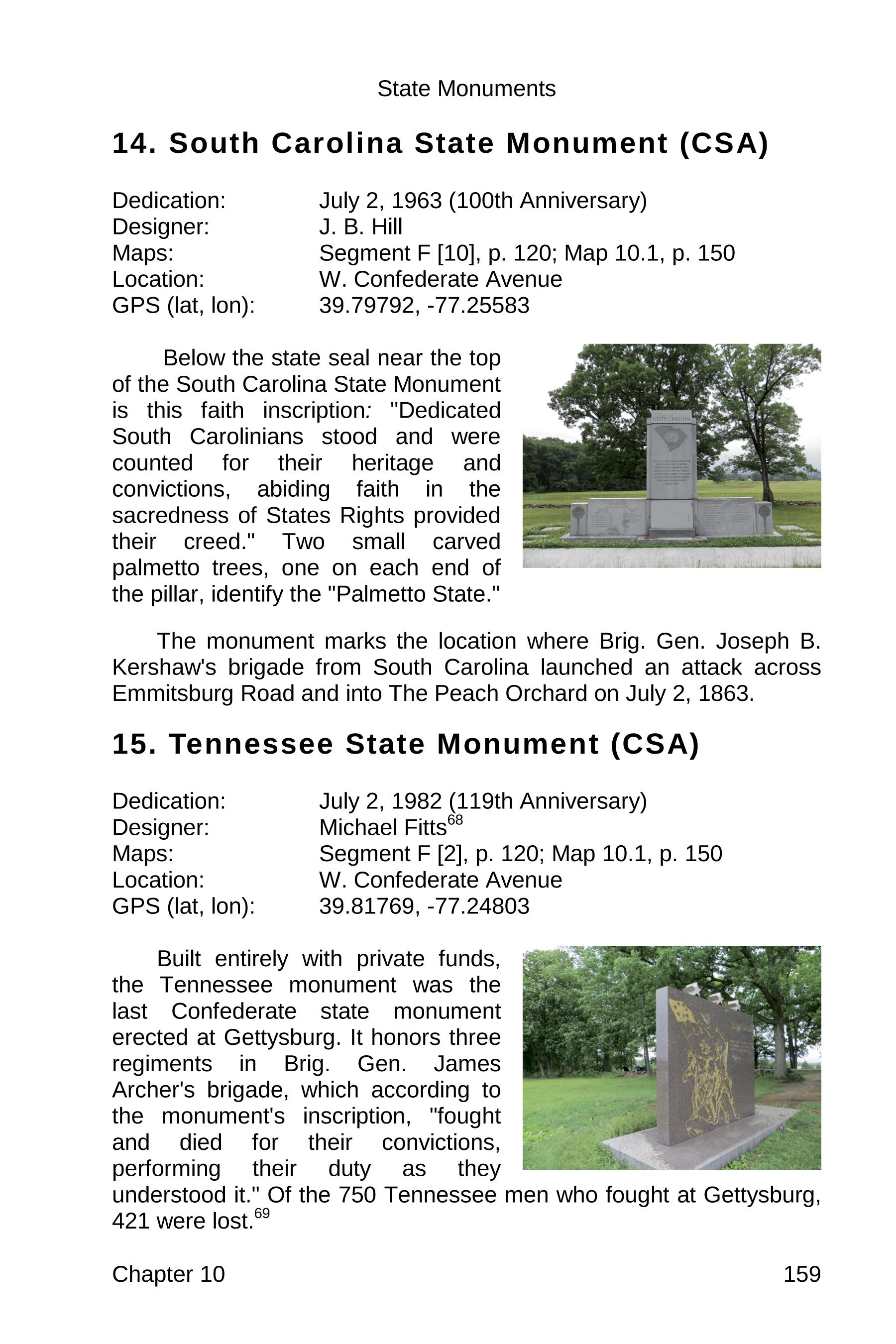
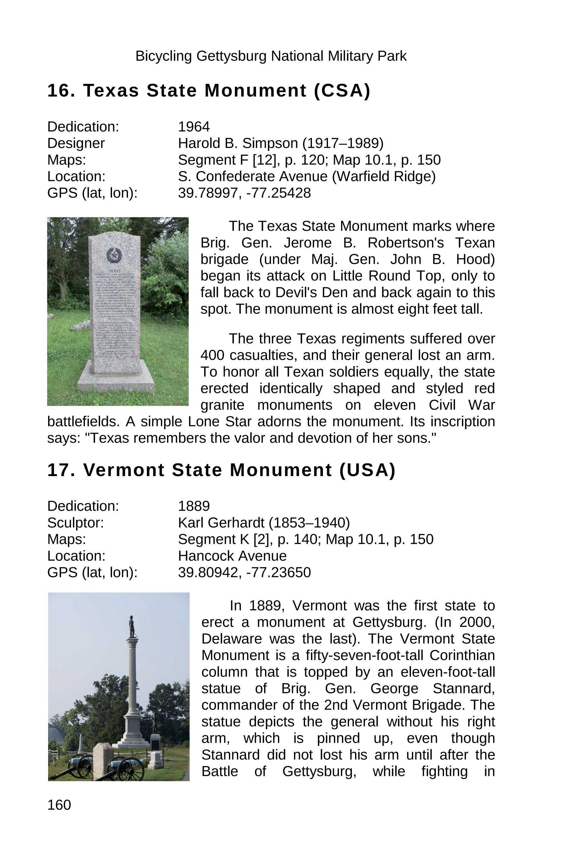
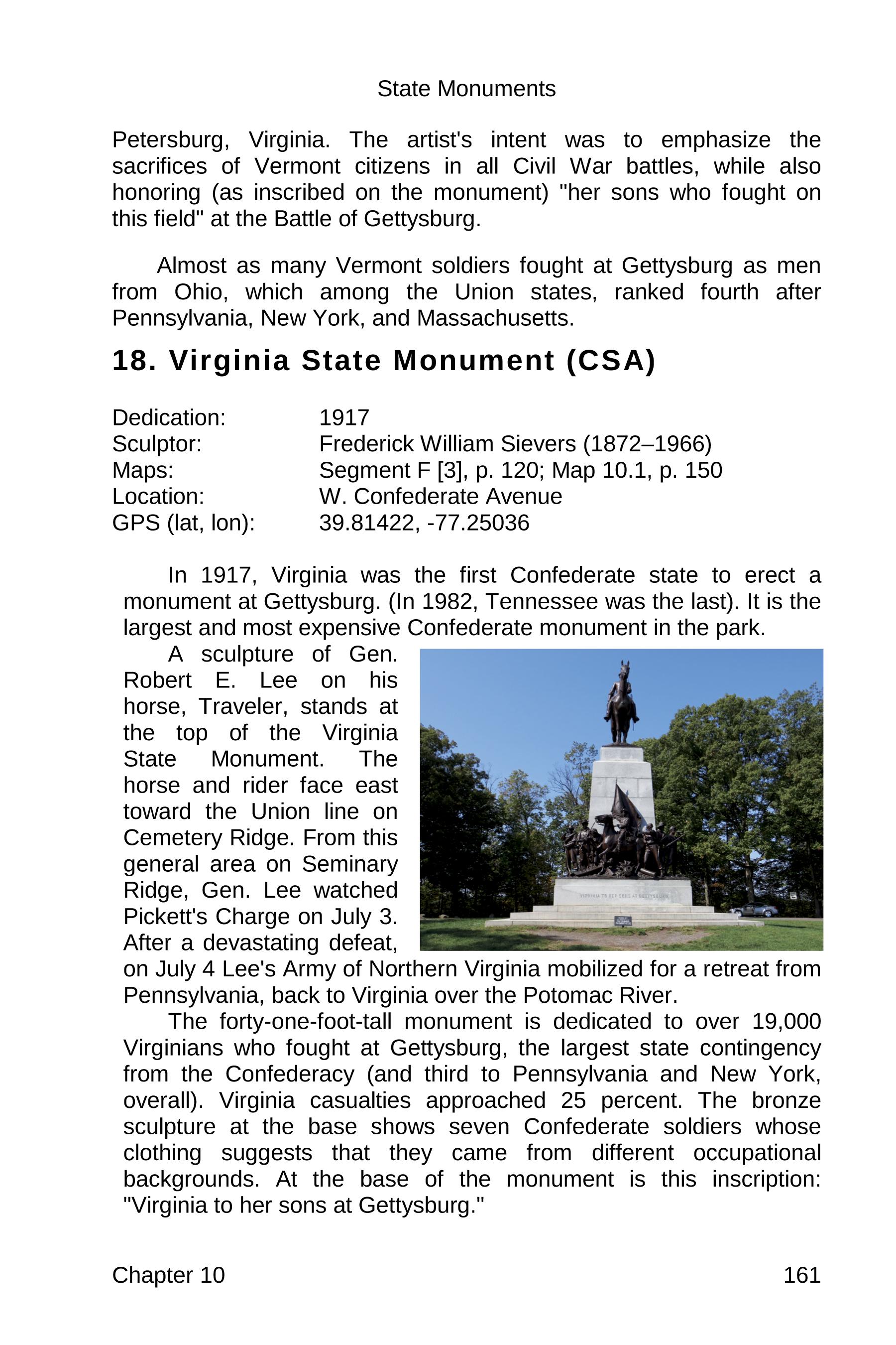
    We hope that even casual visitors to the Civil War Cycling website will enjoy this “Gettysburg State Monuments” sample chapter. This page contains scanned excerpts from chapter 10 of the guidebook, Bicycling Gettysburg National Military Park. The chapter covers Gettysburg’s eighteen state monuments. It illustrates the book’s approach to learning history on a bicycle, which includes learning how battlefield structures, especially monuments, inform our understanding of the Battle of Gettysburg and its historical aftermath. This sample chapter is one of seven chapters in “Part IV: Monuments and Structures,” which is roughly one-half of the book.

    Bicycling Gettysburg National Military Park is unique in that it combines and integrates history, art, photography, cartography, and human interest stories in a way that captures your imagination and intellect. That’s the goal, in any case! Take a peek inside.

    Gettysburg State Monuments Sample Chapter

    Bicycling Gettysburg National Military Park: The Cyclist’s Civil War Travel Guide (Amazon paid link). Copyright © 2019 Sue Thibodeau. All Rights Reserved. Published by Civil War Cycling, Victor, New York.

    gettysburg state monuments sample 149

    gettysburg state monuments sample 150

    gettysburg state monuments sample 151

    gettysburg state monuments sample 152

    gettysburg state monuments sample 153

    gettysburg state monuments sample 154

    gettysburg state monuments sample 155

    gettysburg state monuments sample 156

    gettysburg state monuments sample 157

    gettysburg state monuments sample 158

    gettysburg state monuments sample 159

    gettysburg state monuments sample 160

    gettysburg state monuments sample 161
    Need More Information?

    You might enjoy this post: “On great fields something stays.“

    In addition to the guidebook, Civil War Cycling publishes digital (PDF) maps for 14 different bicycle routes through Gettysburg National Military Park. And guess what? The PDF files do not have license keys or passwords.

  • Auto tour books for bicycling. NOT.

    Auto tour books for bicycling. NOT.

    Are auto tour books safe for bicyclists? Not really.
    If you’re planning to cycle through a U.S. Civil War battlefield, you’ll find no shortage of touring books. Many are excellent—for drivers. But when it comes to the unique needs of bicyclists, nearly all fall short. As of this writing, I know of only two battlefield guides designed specifically for cyclists: Bicycling Gettysburg National Military Park and Bicycling Antietam National Battlefield (Amazon paid links).

    Let’s take a closer look at the pros and cons of using traditional auto tour books for cycling Civil War battlefields.

    In the end, you may find—as I have—that what bicyclists really need is a guidebook built from the ground up for those who want to experience history at ten miles per hour, safely and actively. Auto tour books, though popular, are generally inadequate—and sometimes unsafe—for cyclists who want to follow a tour without sharing narrow roads with fast-moving traffic.

    Auto Tour Books?

    ‘Pros’—Follow an auto tour on your bicycle?

    Pro 1. Auto tour materials are easy to find. Battlefield visitor centers keep them in stock, because they are in high demand.

    Pro 2. The National Park Service distributes free map brochures that include markings for the official battlefield auto tour. You can pick up your copy at the visitor center and sometimes near other park buildings.

    Pro 3. Most are high quality publications. This is especially true of any books that the National Park Service may showcase on a display table.

    ‘Cons’—Follow an auto tour on your bicycle?

    Con 1. Auto tours direct tourists to drive on roads that may not be safe for bicyclists. They typically do not indicate which roads are heavily trafficked, whether or not it is a major commercial artery, or whether there are wide shoulders or sidewalks.

    Con 2. Many auto tours double as maps for tour busses, and so the tour will not take you on roads that are off-limits to busses. In other words, forget about your dream to ride along winding, tree-lined scenic byways, because busses can’t handle them. Of course, this constraint is unfortunate for bicyclists who prefer a more scenic and natural ride far from the hassle of bus traffic.

    Con 3. In order to reduce reliance on other people to pick up a bicyclist at the end of a ride, bicyclists prefer to ride in a loop that not only avoids the need for a car but also makes every  mile meaningful and enjoyable. Planning such a ride is only possible when you have a map that marks all roads, especially one-way roads; but this is not as typical as you might think. In fact, for example, Gettysburg National Military Park has a complicated network of one-way roads that make it challenging to plan circuits that avoid major roads.

    Con 4. Auto tours do not typically identify hills or shade that a bicyclist needs to know in order to stay comfortable on a ride.

    Con 5. Although auto tours may identify the location of restrooms, portable toilets, and picnic areas, tips on the availability of water sources are rare, and during the hot summer months a bicyclist needs to have a good plan to stay hydrated.

    Guidebook?

    All of the ‘cons’ for following an auto tour for bicycling a U.S. military park flip to ‘pros’ for following a guidebook, as follows:

    The best bicycle tours…

    Pro 1. Follow the safest and most enjoyable roads for bicyclists.

    Pro 2. Follow the roads that are off-limits to busses.

    Pro 3. Follow a circuit so that bicyclists can ride in a loop.

    Pro 4. Identify mileage, hills, and shade.

    Pro 5. Identify restrooms, portable toilets, picnic areas, bicycle racks, and water sources.

    CLICK ON THE PHOTO TO ORDER YOUR GUIDEBOOK FROM AMAZON.COM.
    As an Amazon Associate,  I earn from qualifying purchases. Thank you.

    But there’s more!

    The best bicycling guidebooks…

    Pro 6. Include historical summaries that connect the battlefield landscape to historical events. On a bike, an active learner experiences the battlefield in a visceral way — every strain and glide, every drop of sweat — and this makes it incredibly natural to connect today’s experience with battlefield events so long ago.

    Pro 7. Include historical maps that present themes that are easy for bicyclists to consider while riding. Non-specialists often find military maps and tactical jargon difficult to understand. A good guidebook will drive the narrative to its most simple expression without sacrificing meaning. On a bike, battlefield themes are more impactful than numbers, caliber, ranks, and precise times.

    Pro 8. Include color photographs, GPS points, and maps to find significant historic sites and battlefield monuments. Map-to-monument and monument-to-map cross references are essential for the bicycling historian. They help not only with orienteering but with understanding what happened where in the historical narrative.

    Pro 9. Provide tips about bicycle-friendly hotels, bicycle selection, gear, clothing, bicycle rentals, getting to the battlefield, and parking. A major hurdle for many people is the question of whether a bicycle tour is possible and if so, whether it is easy (or hard) or worth the effort (ot not). A guidebook should take the guesswork out of those questions.

    Pro 10. Provide tips on contingency planning (e.g., rain), monitoring park alerts, and ideas about must-see places where bikes are not allowed (e.g., national cemeteries). If you are new to planning any kind of bicycle tip, then you might wonder what steps you need to take to make sure that your trip is enjoyable even if the unexpected happens. A good guidebook will offer suggestions for how to plan for uncomfortable weather or annual events that may attract “too many” people to a battlefield town.

    And finally…

    Pro 11. Provide options to purchase and download digital maps that you can print (to tuck into your jersey or bicycle bag) and/or read on your PDF-enabled mobile device during a stop. Many people ask about digital maps. My opinion is that the more options that you have, the better. And yet I would not recommend relying exclusively on technology for a battlefield trip. I cover the topic here, under the heading “Advantages of Digital (PDF) Maps”

  • Gettysburg Cycling Tips – Guest Post, John Banks Blog

    Gettysburg Cycling Tips – Guest Post, John Banks Blog

    When John Banks invited me to write an article for John Banks’ Civil War Blog, I jumped at the chance to share my “10 Gettysburg cycling tips for adventurous learners.“ It was published on October 26. I hope that you enjoy it. (If you are not familiar with John’s colorful and well-written Civil War history blog, you will find plenty of interesting stories and photographs on his website.)

    Freedom!

    As an introduction to my Gettysburg cycling tips, let me first say this…

    Bicycling Gettysburg is a subject near and dear to my heart. And yet there’s a yearning that is difficult to explain. There’s a pull.

    First, when I bicycle Gettysburg, there’s a natural pull to connect with hills, trees, rocks, and even pavement. I feel alive and free. I am free to ride, free to explore, and free to learn. But also, I feel free to smell like I’ve been playing in the dirt (and quietly proud about that).

    In other words, I enjoy the physical expression of personal freedom. Muscles move, lungs move, and my eyes dart about looking for some new vantage point from which to understand the human story of Gettysburg 1863.

    Second, though, when I am not bicycling Gettysburg, I wish otherwise. l feel a pull to leave New York and head south. I miss the Gettysburg landscape. I miss its countless opportunities to connect not only with the land but with our nation’s history. So, besides feeling personally free, I also think about what “freedom” means in a national context.

    A New Birth of Freedom

    November 19, 1863

    Next month, we celebrate the 155th Anniversary of President Lincoln’s Gettysburg Address at the dedication of Soldiers’ National Cemetery. In 272 words that packed a punch, President Lincoln expressed the meaning of the carnage of Gettysburg — the site of the bloodiest, most deadly conflict in the Western Hemisphere.

    President Lincoln promised that this nation “shall have a new birth of freedom, and that government of the people, by the people, for the people, shall not perish from the earth.”

    One Day after Election Day 2018

    Today, one day after a national election, all of these things are in my mind — bicycling, freedom, Gettysburg, Lincoln, the U.S. Constitution, the Bill of Rights, e pluribus unum. I want to hop on my bike and ride. Unfortunately, it will be a few years before I can move south to Gettysburg to indulge my impulses.

    Gettysburg Cycling Tips … The Big Tease

    Finally, what about those Gettysburg cycling tips? Click here: “10 Gettysburg cycling tips for adventurous learners.“

    Below, please enjoy a reproduction of some of the photographs that you will find in my October 26 post. Follow this link to understand how each photograph connects to a practical tip for exploring Gettysburg National Military Park on a bicycle.

    Civil War Cycling suethibodeau.com image02
    View from Little Round Top, looking southwest.
    Civil War Cycling suethibodeau.com image04
    Union Maj. Gen. George G. Meade Equestrian Monument, Cemetery Ridge.
    Civil War Cycling suethibodeau.com image05
    Confederate Gen. Robert E. Lee Equestrian Monument (on top of Virginia State Monument), Seminary Ridge.
    Civil War Cycling suethibodeau.com image06
    Union cannon on Cemetery Ridge facing the Codori Barn and Seminary Ridge (in the distance).
    Civil War Cycling suethibodeau.com image07
    Looking west from the Copse of Trees on Cemetery Ridge. The Virginia State Monument is visible in the distance.
    Civil War Cycling suethibodeau.com image08
    Looking east near the Virginia State Monument. Can you spot Meade’s Equestrian Monument (left side of the fence, in the distance), the tree at The Angle (right side of the fence), The Copse of Trees (right of The Angle)?
    Civil War Cycling suethibodeau.com image09
    With a good set of maps, you can use Gettysburg’s barns, ridges, roads, and tall historic monuments to stay oriented on the battlefield.

    Please click here to visit John Banks’ Civil War Blog to read how easy it is for bicycling historians (and other outdoor adventurers) to learn-by-doing at Gettysburg National Military Park.

  • Biking the Gettysburg Battlefield—Not Just Any Map

    Biking the Gettysburg Battlefield—Not Just Any Map

    Recently, Civil War Cycling announced the availability of PDF maps for biking the Gettysburg battlefield. Today, this blog post asks the question …

    What’s the big deal?

    Bicycling Gettysburg National Military Park
    ^^^ CLICK to browse

    You might be wondering: Why not just use the official park map for a historical bike ride through Gettysburg? Or rely on a route someone posted to Strava or Map My Ride?

    The truth is, neither option is designed with bicyclists—or history buffs—in mind. And if you try to rely on them, you’re likely to end up frustrated or disappointed.

    If you want a safe, circular, and educational bicycle ride through the Gettysburg battlefield…

    you need either a licensed battlefield guide *OR* maps that are tailored specifically to the needs of a bicycling historian.

    The official park map, as well as GPS routes that you can find online, lack the details that you need for historical touring.

    • They may not avoid town roads.
    • They do not provide information or photographs about monuments or the battlefield landscape.
    • Rarely will they document one-way roads or identify blind curves or shady rest areas.
    • And of course, auto tour guidebooks are designed for motor vehicles, not bicycles.

    Want a licensed battlefield guide?

    7/22/2024 UPDATE: For years, I recommended GettysBike Tours, a small business that operated out of the Bus/RV parking lot near the park’s Baltimore Pike entrance. Unfortunately, GettysBike announced on its website at https://gettysbike.com/ that it closed its business effective January 1, 2024.

    In response to the closure, I updated my guidance on how to find a licensed battlefield guide, which you can read as Tip 1 in the article, “Gettysburg Bicycling Tips”.

    Want maps for a self-directed bicycle tour?

    Civil War Cycling offers flexible options to match your touring style.

    For in-depth planning and rich historical context, explore our 286-page full-color paperback guidebook. If you prefer something more convenient for quick reference during your ride, consider our PDF companion maps, perfect for viewing during a stop.

    Traveling light? Try a compact paperback from our mini-book series, Maps to Bike Gettysburg—designed for cyclists who want essential info without the bulk.

    Maps to Bike Gettysburg Mini-Book Series
    ^^^ CLICK to browse.

    Which is Best for Me?

    If you’re deciding between our Gettysburg paperback guidebook versus the downloadable PDF maps, here’s a breakdown to help:

    Best Option for a Comprehensive Guide

    • Buy the guidebook if you want a detailed guide that includes history, route suggestions, safety tips, and points of interest.

    Best Option for Lightweight Navigation and Highlights

    • Buy the downloadable PDF maps if you want a portable, printable, and zoomable resource to use on a smartphone or tablet during stops in your ride. (Note: These are PDF documents and are not part of a GPS navigation system.)

    Which One Should You Get?

    • If you are planning a self-guided ride and want a historical reference that includes many maps, photos, and tables—Get the paperback guidebook.
    • If you mainly need a visual guide for completing a safe, circular route with clear navigation instructions and tips—Get the downloadable maps. (Tip: We updated and republished some Gettysburg route maps as printed mini-books. For more details, click here.)
    • If you want both history and route details on hand—Consider getting both.

    What No One Told Me About Biking the Gettysburg Battlefield

    Over the course of more than thirty years and dozens of visits, I explored Gettysburg National Military Park by bus, car, and on foot. But everything changed in 2012, when I toured the battlefield by bicycle for the first time. Experiencing American history on two wheels was, in a word, exhilarating.

    Still, it took me four years to refine my approach to self-guided cycling tours.

    Frustrated by the lack of detailed, cyclist-friendly resources, I began creating my own maps and guidebook. Existing maps were often incomplete, inaccurate, or didn’t account for Gettysburg’s many one-way roads. I had no clear guidance on how to avoid town traffic, what gear to pack, what to wear, or where to find water, restrooms, or shaded picnic spots.

    Learning through experience, I eventually discovered the best ways to navigate the park, plan monument visits, and manage time effectively—insights I now share through these custom maps.

    biking the Gettysburg battlefield
    Parked on Slocum Avenue (Culp’s Hill)

    Biking the Gettysburg Battlefield:

    Maps Made for Riders, by a Rider

    Designing a safe, circular bicycle route through Gettysburg National Military Park is harder than it looks—especially if you’d rather not ride against traffic. With so many one-way roads and a confusing network of park, town, and state routes, even experienced cyclists can feel frustrated trying to plan their ride.

    That’s where Civil War Cycling’s maps come in.

    Created specifically for bicyclists of all skill levels, these maps take the guesswork out of touring Gettysburg. Unlike the standard park map, which wasn’t designed with cyclists in mind, our maps help you navigate with confidence by showing you:

    • The safest roads for cyclists
    • One-way road patterns and traffic flow
    • Bicycle laws and policies for the park, town, and state
    • How to legally access areas not typically visited by car
    • Road names not labeled on official park maps
    • Monument and landmark locations
    • Restrooms, water stations, picnic spots, shade, and bike racks

    Why spend hours trying to figure it all out yourself? Ride smarter—with maps designed for the way you move.

    Ride Easy. Focus on the Experience.

    Civil War Cycling’s maps are designed to take the stress out of your ride—so you can focus on the battlefield, not the logistics.

    With these thoughtfully designed maps, you can leave your car behind and forget about unreliable GPS signals.

    Most riders prefer to print the PDF maps and keep them in a jersey pocket or saddle bag for easy access during a quick stop. If your mobile device has a PDF reader, you can also view the maps electronically when you’re off the bike.

    Important safety note: These maps are not meant to be used while riding. Gettysburg’s roads feature many twists, turns, and distractions. Trying to zoom in and navigate a digital map mid-ride can be dangerous. Always stop first.

    Learning Made Simple

    Each of the fourteen cycling routes through the Gettysburg battlefield is divided into manageable segments, making it easy to explore and learn as you ride.

    Every segment highlights a selection of monuments along the route, with numbered markers that correspond to photographs and historical notes—right on the map.

    For example, the Segment E map (shown below) identifies three monuments using numbers that match detailed captions and images, helping you connect the physical landmarks to their historical significance at a glance.

    Sample Segment Map
    Sample Segment Map

    Discover Gettysburg on Two Wheels

    Exploring the Gettysburg battlefield by bike is a hands-on journey through history. Civil War Cycling’s maps give you the structure and guidance to turn every mile into a meaningful learning experience.

    Start your adventure—get your maps today!

    Table of Gettysburg Bicycle Routes

    Civil War Cycling’s bicycling maps are historically themed, circular routes over park roads that are designed for safety and cycling convenience. You may print these multi-page color PDFs to tuck into your jersey, bicycle panniers, or handlebar map bag. If your mobile device has a PDF reader, you can also digitally view your maps while on a break. There are no license keys or passwords. Simply purchase, download, and use.

    Note: On a mobile device, you may need to swipe the following table to the left to get to the ‘Read More’ links.
    Route #Route NameMilesThemeLink
    1Full Day Loop23.8*Best Seller* Maximum battlefield coverage for July 1-3, 1863 [Tricky zig-zag through town to get to the Day 1 battlefield]Read More
    1bFull Day Short Loop11.5 *Popular* Abbreviated coverage of key battlefield sites for July 1-3 [Requires above-average road cycling skills]Read More
    2Battle Day 1 Loop10.5Fields north of town and part of Culp’s Hill [For the serious historian]Read More
    3Battle Days 2 & 3 Loop17.0 *Popular* Southern half of the battlefield, plus a complete tour of Culp’s Hill
    Read More
    3bBattle Days 2 & 3 Short Loop10.7 *Popular* Abbreviated coverage of key battlefield sites for July 2-3Read More
    4The Ridges Loop9.0Simple route over the July 2-3 battlefield south of town, excluding Culp’s HillRead More
    5The Ridges Extended Loop12.2*Popular* Adds to Route 4 a ride through Devil’s Den, Rose Woods, and the Trostle Farm areaRead More
    6, 7Culp’s Hill Lower & Upper Loops2.4 (each)Culp’s Hill divided into two loopsRead More
    8Culp’s Hill Double Loop5.5Complete tour of Culp’s Hill, including East Confederate Avenue [Recommended for your second tour of GNMP]Read More
    9, 10, 11Devil’s Den, The Wheatfield, and Little Round Top Loops1.5 – 3.8Devil’s Den, The Wheatfield, and Little Round Top [Simple route, physically demanding]Read More
    12East Cavalry Field5.2East Cavalry Field [For expert road cyclists only. Most of this tour is not within park boundaries.]Read More
    Gettysburg Route 1 Bike Map
    ^^^ CLICK to browse all available PDF maps for cycling the Gettysburg battlefield.
    Click here to shop for guidebooks and maps.

    Happy Cycling!

  • Bike Ride to the Gettysburg Eternal Light Peace Memorial – A Video

    Bike Ride to the Gettysburg Eternal Light Peace Memorial – A Video

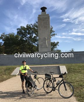
    On a bicycle, you can feel the battlefield advantage of making it to high ground. I had that experience on a bike ride to the Gettysburg Eternal Light Peace Memorial. In the spirit of sharing what it is like to pedal up to Oak Hill, I posted my GoPro video of the ride on my Civil War Cycling Facebook page. And in this blog post, I provide more geographical and historical context — plus a window to that bicycling video.

    Where is the Eternal Light Peace Memorial?

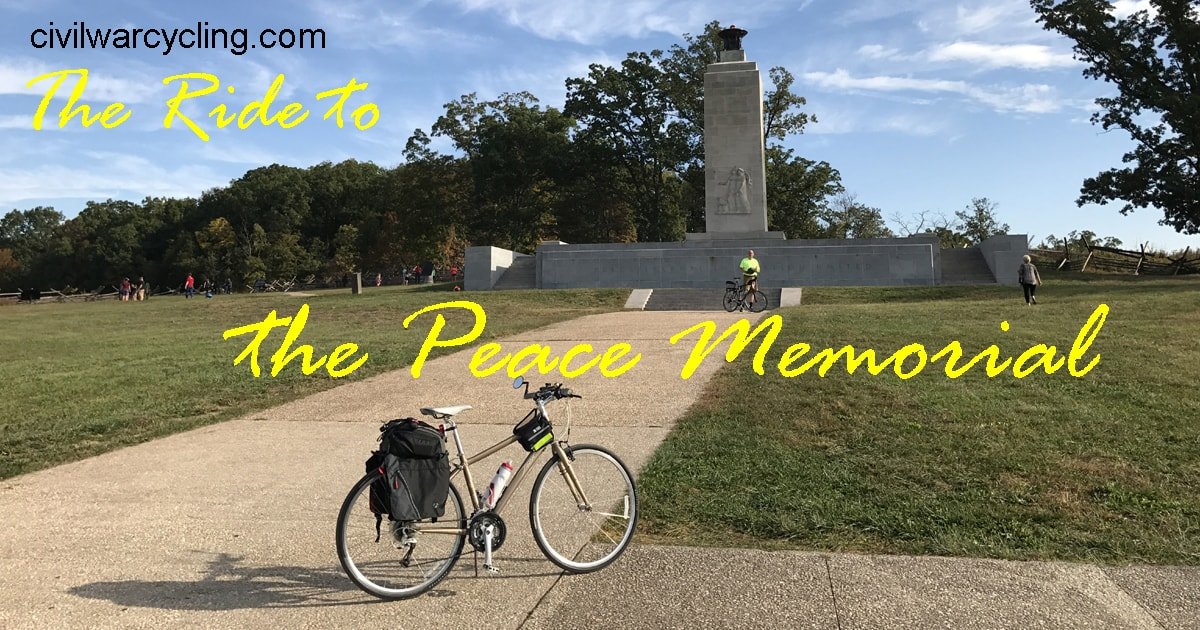
    The Eternal Light Peace Memorial is on Oak Hill, north of the town of Gettysburg, Pennsylvania. It was from here that Confederate artillery and infantry attacked the 1st Corps, Army of the Potomac, on July 1, 1863.

    President Franklin D. Roosevelt spoke at the memorial’s dedication on the 75th Anniversary of the Battle of Gettysburg in July, 1938. To symbolize peace between between warring sections of the country, Maine granite at the monument base joins the Alabama limestone column. An estimated one-quarter of one million people assembled on Oak Hill to celebrate the dedication of the Eternal Light Peace Memorial.

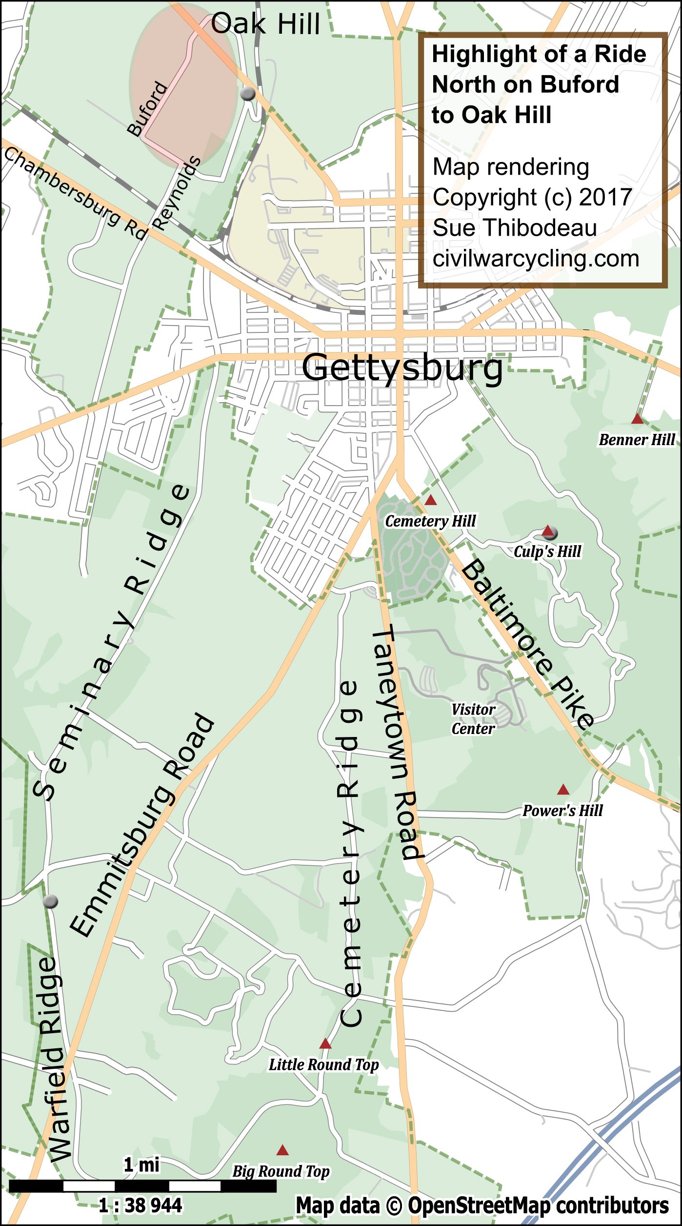
    North on Buford Avenue to Oak Hill

    bike ride to the Gettysburg Eternal Light Peace Memorial

    Our video begins at the intersection of North Reynolds Avenue and Buford Avenue, where we turn left (west) and enjoy a subtle downward glide to about 560-feet Mean Sea Level. During this first leg of our short tour, we are riding down the west edge of Seminary Ridge.

    As we veer sharply right — still on Buford Avenue — and ride north, we begin a gradual but noticeable incline. Buford Avenue runs north toward Oak Hill and marks a battle line along which Confederate infantry attacked Union cavalry from the west.

    Buford Avenue is named after Maj. Gen. John Buford, the 1st Corps cavalry commander who held back Confederate Maj. Gen. Henry Heth’s infantry on the morning of July 1, 1863, until Union infantry under Maj. Gen. John F. Reynolds could arrive in Gettysburg.

    The video of my  bike ride to the Gettysburg Eternal Light Peace Memorial shows a bicyclist passing five monuments on the east (right) side of the road. For your convenience, the following links to Steve Hawks’ Gettysburg Stone Sentinels describe those monuments:

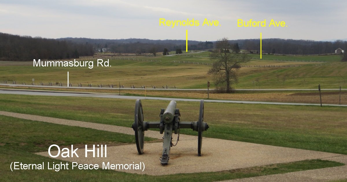
    We follow Buford Avenue north all the way to the Eternal Light Peace Memorial at the top of the hill. According to the U. S. Geological Survey, Oak Hill stands at 616-feet Mean Sea Level, which means that we will have climbed about 56-feet. The next photograph was taken while standing just west of the Peace Memorial (January 1, 2016). Looking down from Oak Hill, you can see the roads a bicyclist would follow — from Reynolds Avenue to Buford Avenue and finally crossing Mummasburg Road to arrive at Oak Hill.

    bike ride to the Gettysburg Eternal Light Peace Memorial
    View Looking South from Oak Hill

    Bike Ride to the Gettysburg Eternal Light Peace Memorial – A Video

    March 2025 Update: For performance reasons, our video has been removed from this web site. I apologize for any inconvenience.

  • Flying Down Culp’s Hill on a Bicycle – A Video

    Flying Down Culp’s Hill on a Bicycle – A Video

    The thrill of flying down Culp’s Hill on a bicycle is an unmatched experience for Gettysburg tourists. To give you a feel for this exhilarating and all-too-short ride, I posted my GoPro video of the ride on my Civil War Cycling Facebook page. And in this blog post, I provide more geographical and historical context — plus a window to that bicycling video.

    Where is Culp’s Hill?

    Culp’s Hill is southeast of the town of Gettysburg. Young Gettysburg native Wesley Culp — a member of the family for whom the hill was named — was living in Virginia when the Civil War started. He joined the Confederate army as a private and fought and died at the Battle of Gettysburg. We do not know where he died or where he is buried.

    Culp’s Hill was the right anchor of the Union line during the battle. According to the U.S. Geological Survey, the hill is at 629 feet Mean Sea Level. The lowest nearby location is Spangler’s Spring, which is at 469 feet Mean Sea Level.

    The paved park road from Spangler’s Spring to the summit of Culp’s Hill is a steep 160-foot, 3/4-mile climb up Slocum Avenue, a road that was named after Major General Henry W. Slocum (1826-94), commander of the Union right wing at the Battle of Gettysburg (July 1-3, 1863). The ride down Culp’s Hill is also part of Slocum Avenue.

    Flying Down Culp’s Hill on a Bicycle – A Video

    Our video begins at the summit of Culp’s Hill — at an observation tower built in 1895 — and follows Slocum Avenue down (southwest) to Stevens’ Knoll. We end at the road’s intersection with Wainwright Avenue, near a monument to the 33rd MA Infantry.

    March 2025 Update: For performance reasons, our video has been removed from this web site. I apologize for any inconvenience. 

    The ride down Culp’s Hill is a fast 0.2 mile glide into Stevens’ Knoll, where — not visible in the video — stand several restored Civil War Era cannon and a couple monuments, most notably the equestrian monument of Major General Henry W. Slocum.

    We bend north another 0.1 miles to reach the 33rd MA Infantry monument, on our right. East Cemetery Hill is straight-ahead. From the fields to our right, Confederates attacked East Cemetery Hill and Stevens’ Knoll.

    What Happened at Culp’s Hill?

    flying down culp's hill on a bicycle
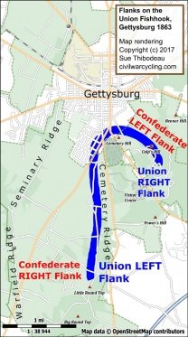
    Culp’s Hill marks the Union right.

    On Culp’s Hill, Union troops dug earthen trenches that prevented Confederates from gaining the high ground, and thus protected the Union line that wrapped west around Cemetery Hill and then south along Cemetery Ridge to Little Round Top.

    On July 2, 1863, at about 4:00 P.M., Confederate artillery on Benner Hill bombarded Union positions on Culp’s Hill and Stevens’ Knoll. From about 8:00 – 10:00 P.M., Confederate infantry attacked Culp’s Hill from the east (along modern-day East Confederate Avenue). The Union line held.

    On July 3, 1863, early in the morning, Union infantry on Culp’s Hill launched a surprise attack on the Confederates. By 11:00 A.M., the battlefield action on Culp’s Hill ended with the Confederates falling back.

    It is interesting to note that the two oldest Union and Confederate generals at the Battle of Gettysburg fought each other on Culp’s Hill. Union general George S. Greene was 62 years old, and Confederate general William Smith was 65 years old.

  • 6 Steps to Create Your Own Gettysburg Scavenger Hunt

    6 Steps to Create Your Own Gettysburg Scavenger Hunt

    Have you ever thought about creating your own Gettysburg scavenger hunt? For bicycling? With over 1,300 monuments and markers in Gettysburg National Military Park, the battlefield is a rich wonderland of opportunities. Try these step-by-step instructions to plan your next history tour. And I’m going to make it easy for you. Read on to see how.

    What is a Battlefield Scavenger Hunt?

    Civil War Cycling is about touring U.S. national military parks by pedaling along park roadways. With that in mind, when we speak about “scavenger hunts,” we are talking about riding our bicycles on park roads in search of specific historical artifacts or structures.

    scav·eng·er hunt /’skavənjər hənt/
    noun: scavenger hunt; plural noun: scavenger hunts
    a game, typically played in an extensive outdoor area, in which participants have to collect a number of miscellaneous objects. Source: Google

    Bicycling historians “scavenge” the outdoors to find items on a “scavenger hunt” list. For me, the hunt is complete when I have snapped photographs of everything on my list.

    Examples

    1. Seven USA state monuments at Gettysburg National Military Park (GNMP)
    2. Eleven CSA state monuments at GNMP
    3. Eight equestrian monuments at GNMP
    4. Eighteen (plus two) bronze statues of individuals at GNMP or nearby cemeteries

    Why Plan a Gettysburg Scavenger Hunt?

    Gettysburg scavenger hunt

    Gettysburg National Military Park has 1,300+ monuments and about 400 refurbished cannon spread over 6,000+ acres and about thirty-one miles of park roads. Clearly, that is way too much to see in a single day’s ride. I have no idea how long it would take to visit every monument or marker, and I have logged dozens of full-day rides.

    Even so, these massive numbers do not make a Gettysburg scavenger hunt necessary. You could, for example, enjoy freely exploring the park and stopping to read historic waysides and monument inscriptions in a random, possibly whimsical, manner. Admittedly, when I take three-day bicycling trips to Gettysburg, my last day is always dedicated to that sort of impulsive, free-form ride.

    Why plan a battlefield scavenger hunt?

    First, because it is an effective way to learn history.

    If you begin your ride with a plan to visit a particular set of monuments that share a common theme, your learning experience is strengthened. In other words, scavenger hunts offer a coherent and thematic — as opposed to a random, disjointed — learning opportunity.

    Second, because it gives a solid sense of accomplishment.

    If you are bicycling a U.S. national military park in order to learn more about American history, a ride that is focused on a particular historical theme or goal provides a greater sense of accomplishment than if the ride had no defined historical objective.

    For example, in my first attempt to identify, map, find, and photograph all corps headquarter monuments at Gettysburg, I probably found only about half of them. There are many reasons for a less-than-perfect “score” on my Gettysburg scavenger hunt — including the monuments’ small sizes, their odd locations, and even bad weather and a drained camera battery. But that’s not the point; instead, the point is that I felt a strong sense of accomplishment when I was able to complete that hunt on another ride.

    Third, because it is fun.

    Scavenger hunts provide bicyclists an opportunity to combine hobbies like bicycling, history, cartography, and photography into one outdoor learning adventure.

    What Makes for a Great Battlefield Scavenger Hunt?

    The key to planning a Gettysburg bicycle route that visits a meaningful set of sites is to scale-down your expectations of what can be accomplished on a single day’s ride.

    In a nutshell, there are four criteria for a great battlefield scavenger hunt:

    1. The list contains historically interesting physical items that you can photograph.
    2. It is logistically possible to find all items on the list in one ride or set of smaller rides.
    3. You or someone else has researched the (paper) location of each item on the map.
    4. During your ride, you have a way to “check off” each item that you find.

    6 Steps to Create a Gettysburg Scavenger Hunt

    I said that I’d make this easy for you, and I will! Please follow these step-by-step instructions:

    Step 1 – Visit Web Link

    Visit Civil War Cycling’s “Gettysburg Scavenger Hunts – Explore Like a Kid” page. Skim the evergreen, multi-page table of scavenger hunts available for your use. Pick one that interests you.

    Step 2 – Click on “Hunt”

    Next, click on one of the “Hunt” links on the page from Step 1. If you have never bicycled Gettysburg, I recommend that you select one of the following hunts:

    1. USA State Monuments
    2. CSA State Monuments
    3. Equestrian Monuments

    Then read the short introduction at the top of the article.

    Step 3 – Read and Think

    For a single hunt, study the following on the “Hunt” page that you selected in Step 2:

    1. Table description of each monument
    2. Map pin for each monument
    3. Photo of each monument

    And then most importantly, do the mental work of jumping from table to map to photograph — in whatever order makes sense to you — as you memorize the attributes of each monument:

    1. Name (from the table)
    2. Location (map pin)
    3. Appearance (photo)

    Step 4 – Make a Simple Map

    Download a PDF map of Gettysburg National Military Park. A paper version is also available in the kiosks at the Gettysburg Museum and Visitor Center.

    Refer to Civil War Cycling’s pins on Google Maps, and then mark their location on your paper map. Let it be messy. After all, your “trophy” for the hunt is a set of photos.

    Step 5 – Design a Bicycle Route

    This next step probably requires the most thought, but most bicycling tourists enjoy it:

    Design a circular route that visits each location that you marked on your map from Step 4. If you’d like to skip ahead, it is very likely that one of Civil War Cycling’s pre-made bicycle routes will work for you.

    In future posts, I will offer detailed guidance with the finer points of bicycling Gettysburg National Military Park safely and efficiently. However, if you will be riding before those posts are available, please consider reading these articles first:

    Step 6 – Ride

    Finally, please enjoy your ride! Hunt with your camera, and check-off what you find (in case you need to repeat your Gettysburg scavenger hunt on another ride).

  • 4 Simple Steps to Plan a Battlefield Bicycle Tour

    4 Simple Steps to Plan a Battlefield Bicycle Tour

    It is easier to plan a battlefield bicycle tour than you might think. In fact, it’s probably easier to plan a bicycle tour of a U.S. national military park than it is to plan a typical family vacation — cruises and Walt Disney World may be the only exceptions. In any case, I urge you to consider whether Civil War Cycling’s four simple steps to plan a battlefield bicycle tour might be something that you could do. My bet is yes.

    Plan a Battlefield Bicycle Tour in 4 Simple Steps

    You may be surprised to discover that your greatest challenge to planning a battlefield bicycle tour has nothing whatsoever to do with bicycling or historical tourism. What is it then? It is predictable things like getting time off work, having money for a modest vacation, being healthy enough to travel or bicycle, and — for some people — not having a companion (and needing one).

    Basically, planning a battlefield bicycle tour is not much different from planning any vacation. Sure, there are a couple unique twists to consider, but Civil War Cycling can help with that.

    There are four simple steps to plan a battlefield bicycle tour. They are as follows:

    1. Pick a Battlefield

    The U.S. National Park Service website provides a way to “find a park by state,” but the search results will include all national parks. U.S. military parks are a small subset of the full list.

    Fortunately, you probably already have an idea of what battlefields you might like to visit. I suggest that you surf the web in the same way that you would for any vacation — and get a sense for what you might enjoy doing.

    As a personal example, here’s the “bucket list” that I have been working:

    Carmen Avenue, Culps Hill Area, Gettysburg

    2. Identify Logistical Options

    You Need a Bicycle

    People tend to get stuck at this step. To plan a battlefield bicycle tour, you basically have two options. The first option is to research the availability of bicycle rentals near the battlefield that you intend to tour. Many bicycle shops offer rentals that include helmets. Google it.

    The second option is to transport your own bicycle. If you are within driving distance of the battlefield (and you have a car), then your research will go down the path of how to transport and store your bicycle. If you need to take a flight to the battlefield, I recommend pursuing a bicycle rental option before taking the very expensive and complicated step of airlifting your bicycle. (That’s something that I’ve never done, and I don’t think I would ever want to hassle with it.)

    Did you miss this post?

    Trek Hybrid Bicycle on Hancock Avenue, Gettysburg

    You Need a Place to Sleep (and Eat)

    I wanted to title this section, “You Need a Hotel,” but there are plenty of people who “bikepack,” which means that they setup camp. Although I would enjoy combining tent-camping with bicycle touring, I have not done it. I know how to find bicycle-friendly hotels <smile>.

    Did you miss these posts?

    3. Just Say “Yes!”

    Like many things in life, the hardest part of planning a battlefield bicycle tour is deciding to do it. Most people don’t find vacation planning particularly difficult. It’s mostly a matter of finding time and working within a budget.

    Once you commit to the idea of bicycling a U.S. military park, it’s really not hard to pick a battlefield. And once you know whether you are renting a bicycle (and from where) or bringing your own (and how), it’s really not hard to execute that plan.

    Just say “yes”! And then follow the “5 Tips for Planning a Great Civil War Bicycling Adventure” that I summarized in a previous post.

    4. Enjoy Your Ride

    I’m almost embarrassed to mention this last point. After all, of course you will enjoy your ride! That’s the whole point of planning your Civil War bicycling adventure.

    Did you miss these posts?

    Looking back on steps 1-3, above, I hope you agree that planning to have fun on a bicycle is not hard. You might even agree with me that the planning steps can be fun, too!