Although it has been a while since I posted on this blog, you will notice that there is a lot new at Civil War Cycling. What follows is a summary of the highlights.
Sitewide Structural Edits
First and foremost, I rewrote and restructured our Gettysburg Study Notes for a simpler, more modern presentation. This included a site-wide upgrade in web styling and reduced dependency on non-standard software enhancements.
Additions to our Annotated Bibliographies
New books about the U.S. Civil War continue to be published. In large measure, I believe that I have identified and commented on a good many of those associated with the topical headings on the following pages:
I added hyperlinked versions of the Federal and Confederate Orders of Battle for Gettysburg. These new pages include tables of contents, internal page navigation links, indexes for artillery and state affiliation, and external links to the Official Records (for officer reports), Soldiers and Sailors Database (for unit histories), Wikipedia (for biographies), and the American Battlefield Trust (for articles). They also include portrait and monument photo links to the Civil War Cycling gallery, as well as links to quizzes on commanders’ direct reports.
Published in 1889 by the U.S. government, the Official Records has the formal title, The War of Rebellion: A Compilation of the Official Records of the Union and Confederate Armies. Recently, Civil War Cycling created two sets of hyperlinked indexes to ease your online reading of the Official Records for the Gettysburg Campaign:
For a taste of the Official Records, try these excerpts from Civil War Cycling indexes, which link to 1889 documents scanned by Cornell University Library and delivered electronically by HathiTrust:
No. 71.—Col. Charles S. Wainwright, First New York Light Artillery, commanding Artillery Brigade, First Army Corps. (OR 27,1:354-359)
No. 513.—Brig. Gen. Alfred Iverson, C. S. Army, commanding brigade. (OR 27,2:578-581)
No. 534.—Lieut. Gen. Ambrose P. Hill, C. S. Army, commanding Third Army Corps. (OR 27,2:606-609)
New Cycling Adventures
I have been back to Gettysburg several times since the global pandemic made traveling difficult. Then came the 18-month-long National Park Service rehabilitation work in Devil’s Den and Little Round Top. Thankfully, that has completed, and it looks great. I hope soon to post photos on this website (since my habit has been to post to Facebook while at a battlefield site).
Happy Cycling!
~Sue
Dear Subscribers:
Civil War Cycling is retiring its newsletter subscription service due to unsustainable cost increases. But we are not going anywhere. Please continue to keep in touch. And thank you for subscribing!
Please consider periodically visiting civilwarcycling.com to check for new material or to enjoy the golden oldies.
I am excited to announce that McFarland has published my husband’s (Timothy M. Thibodeau) latest book—Henry V, Holy Warrior. The book will appeal to “advanced undergraduate or beginning graduate students who are new to the study of Shakespeare’s Henry V, or who are enrolled in a course on medieval English history or the Hundred Years War.” (p. 4)
Obviously, this book is not about the U.S. Civil War. It covers a different century and a different continent.
But you might be surprised about one thing. According to Tim, bicycling U.S. Civil War battlefields stimulated “his best thinking about the historian’s craft.” In fact, he specifically mentions in his book the value of touring the Gettysburg, Antietam, Chickamauga, and Shiloh battlefields. These battlefields impressed upon us a difficult to explain appreciation of history and historiography. For me, the experience drives home the importance of people, their livelihood, and their land to any military history.
I share this announcement for personal reasons, as should be no surprise. First, I admit my bias in favor of Tim’s academic projects and our joint bicycling vocation. He’s my husband, after all. Second, I contributed to the book by creating its three military maps. Since bicyclists tend to love maps, I hope that you pick up a copy of Henry V, Holy Warrior.
About King Henry V
King Henry V was one of the most famous military commanders in English history. And thanks to William Shakespeare, in whose play Henry delivers the “band of brothers” speech before a crucial battle, Henry remains a popular historical figure.
His victory against the French at Agincourt in October of 1415 gave Henry legendary status as a brave soldier and brilliant military tactician. By some estimates, the French forces that had gathered to stop Henry’s invasion outnumbered the English 3: or 4:1. They fought to end Henry’s claim to the French crown. But Henry’s archers and their longbows slaughtered the French cavalry forces that repeatedly attempted to overrun them.
June 2022 will mark the 600th anniversary of Henry V’s death.
Editorial Review
This book is original in its broad overview of the voluminous and contentious scholarship on Henry V and its reasonable perspectives, steering between the romantic hero-worship now more than a century beyond its expiration date and more recent a historical denunciations made without sufficient regard for the fifteenth-century context.
Timothy M. Thibodeau is a native of Aroostook County, Maine, of French Canadian ancestry. He earned a B.A. in history from the University of Maine, and an M.A. and Ph.D. from the University of Notre Dame. His research interests include medieval Christianity, the Hundred Years War, the life of Joan of Arc and historical film studies. He has been a contributor to national and international media outlets, including the History Channel.
Road closures near Little Round Top will impact your Gettysburg bicycle tour this year. The National Park Service announced two major rehabilitation projects that will be in full swing on July 26, 2022 and continue for 18 months. For the latest official information about dates and park conditions, visit the Gettysburg Alerts & Conditions web page. Also of interest, the National Park Service posted an “Auto Detour Map” (2025 Update: the map is no longer accessible).
The Little Round Top Rehabilitation Project impacts Civil War Cycling Routes 1, 1b, 3, 3b, 4, 5, and 9-11. However, these routes are not impacted: Route 2 (Battle Day 1 Loop) and Routes 6-7, 8 (Culp’s Hill). Using today’s blog tips and a little pre-planning to adjust your route, you can enjoy an educational Gettysburg bicycle tour this year.
This post was updated on April 29, 2022 to include the Devil’s Den project.
Here are five tips for adjusting your Summer/Fall 2022 Gettysburg bike tour:
Tip 1. Avoid construction near Little Round Top.
For bicyclists who want to use their existing Civil War Cycling map sets, this article describes the detour for Route 1 (“Full Day Loop”). If you are a potential new customer, please browse our shop, here. Notably, Warren Avenue, Sykes Avenue, and Wright Avenue will be closed to all traffic starting in the late Spring, 2022. South Confederate Avenue will be open to hikers and bicyclists.
2022 Gettysburg Bicycle Detour Cues
Fortunately, we can describe a detour that applies to all impacted Gettysburg bicycle routes. In other words, only one detour around park road closures is needed for Civil War Cycling Routes 1, 1b, 3, 3b, 4, and 5.
You will start at the north end of West Confederate Avenue (“old” Segment F) and ride only as far as Millerstown Road before cutting east toward The Peach Orchard, as follows:
From the north end of West Confederate Avenue, ride 2.1 miles SOUTH to Millerstown Road.
At the stop sign, turn LEFT on Millerstown Road and ride about 0.3 miles to Emmitsburg Road.
Cross Emmitsburg Road and take your first LEFT on Sickles Avenue.
Turn RIGHT on United States Avenue and ride 0.7 miles to a dead-end.
Turn LEFT on Hancock Avenue and ride NORTH to the Pennsylvania State Monument (to begin Segment K).
2022 Gettysburg Bicycle Detour Map (for Route 1)
Although the detour cues are straight-forward, it always helps to have a map. The following overview map depicts the detour from Segments F2 and G3 to Segment K.
Note: Don’t let the segment names confuse you. Since the same segments are recombined to produce different routes, their ordering for any given route will appear arbitrary. In addition, Civil War Cycling’s PDF products include detailed maps, bicycle cues, and photos for each bicycling segment, which means they are packed with more information than this simple blog post can provide. In other words, overview maps like the one below represent only a small subset of a Civil War Cycling “companion map.”
This version of Route 1 covers 16.7 miles, compared to 23.8 miles for the Route 1 “Full Day Loop.” The 7.1 miles that we cut from this route are amongst the most historically significant, not to mention beautiful, parts of the Gettysburg landscape.
That said, rather than short-circuit our options, Tip 2 will describe a potential opportunity to ride 2.7 miles through The Wheatfield, Devil’s Den, and Rose Woods.
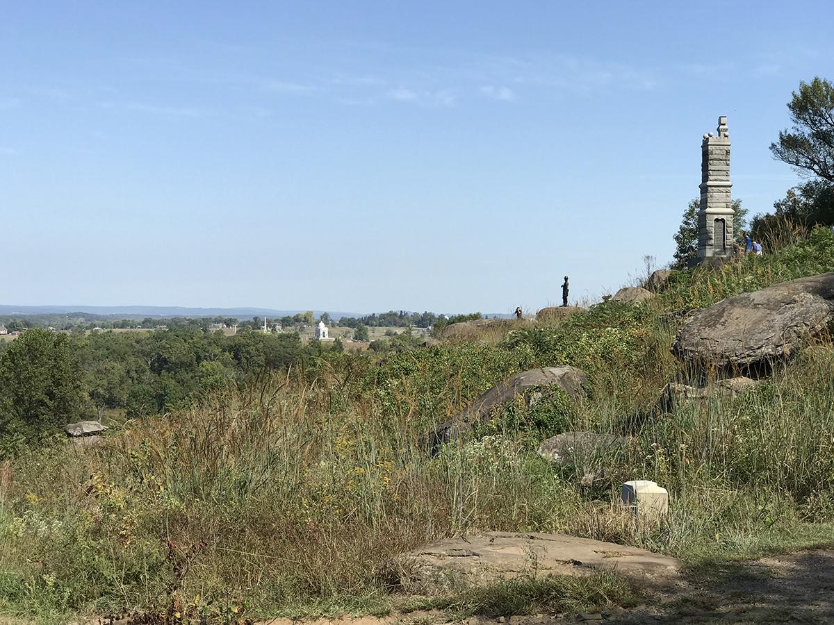
South slope of Little Round Top, looking toward Union monuments on Hancock Avenue.
Tip 2. From Segment G3, consider touring Devil’s Den.
Technically, the National Park Service has CLOSED Devil’s Den until the end of September, 2022. They fenced off the area’s 200 million year-old boulder outcropping to make it inaccessible to pedestrians. The project will remedy safety and erosion issues.
On the other hand, the surrounding roads will be mostly OPEN. Since road closures will depend on the current state of construction work, please check the NPS Alerts & Conditions page for up-to-date information on the day of your Gettysburg bicycle ride.
For the safety of all visitors and contractors, Devil’s Den will be closed for five to six months. However, Crawford Avenue, Sickles Avenue, and the Devil’s Den parking area will remain open as much as possible for visitor use. (Adjacent battlefield locations, such as the Slaughter Pen, Devil’s Kitchen, and the Triangular Field, will all remain open.) The construction contractor will occasionally need to close all road access around the area in order to further facilitate the project. All road closure notices will be updated to our website and social media platforms with as much notice as possible.
View of Devils Den, looking southwest over Warren Avenue from Little Round Top.
Can you loop around Devil’s Den?
Maybe. Due to the uncertainty about which roads may close when, Civil War Cycling’s 2022 Gettysburg bicycle detour recommendations do not include the Devil’s Den area. But that doesn’t mean that you are out of luck.
Road conditions on the day of your ride might permit a spontaneous 2.7-mile ride through these battlefield locations: The Wheatfield, Devil’s Den, and Rose Woods. Please note that for visibility reasons these roads are normally one-way, and that fact will impact your detour options. (See the black arrows on the map below).
You will start and end in The Peach Orchard after completing Segment F2 and before Segment G3.
2022 Gettysburg Bicycle Detour Cues for Devil’s Den
Continue STRAIGHT (southeast) on Wheatfield Road.
Take your third RIGHT (almost 0.5 miles) onto Crawford Avenue.
Follow Crawford Avenue 0.3 miles to the stop sign at Warren Avenue.
Continue STRAIGHT onto Sickles Avenue for 0.3 miles around Devil’s Den.
Continue 0.2 miles to an oddly angled intersection and turn LEFT. This is Cross Avenue.
Continue 0.8 miles over Brooke and Detrobriand Avenues to the STOP at Sickles Avenue.
Turn LEFT on Sickles Avenue and continue 0.4 miles to the STOP at Wheatfield Road.
Turn LEFT and ride 0.2 miles to arrive back at the start of Segment G3.
Tip 3. Avoid West Middle Street by crossing into a neighborhood.
This tip is unrelated to 2022 park construction projects. If your Civil War Cycling route zig-zags to West Middle Street via residential streets, you know that the final climb up West Middle to the traffic light at Seminary Ridge Avenue is steep. We recommend riding on the sidewalk, since West Middle Street is a fast-moving commercial road.
But there is an alternative. Rather than riding up West Middle Street, cross the road into another residential neighborhood. Then turn left and ride about two blocks to dead-end on Seminary Ridge Avenue. From there, you can ride south (left) to connect to West Confederate Avenue, or north (right) to tour the Day 1 battlefield.
Tip 4. Riding with children? Try tree-lined Seminary Ridge.
Although Gettysburg’s park roads are safe for adult bicyclists, children require close supervision. All bicyclists must share the road with motor vehicles (25 mph speed limit), and children should have prior experience riding in these conditions and understand the rules of the road. You know this, of course.
The easiest way to avoid fast-moving public roadways on a Gettysburg bicycle tour with children is to plan a “back and forth” ride. And the most scenic straight-away is the ride south on West Confederate Avenue, which bends eastward on South Confederate Avenue, past Big Round Top to Little Round Top. These wide, smoothly paved roads roll gently along a tree-lined ridge (Seminary Ridge). On the side of the road stand many large Confederate monuments and cannons that tell the story of “Pickett’s Charge” across a 1-mile-wide field to your left, beyond which you can see Union monuments on the opposing ridge (Cemetery Ridge).
Instructions
Park your car on the north end of West Confederate Avenue, unload your bicycles, put on your helmets, and ride south. Bring plenty of water and healthy carbohydrates or snacks. When you are “half-way tired,” turn around and ride back to your car.
Confederate Cannon on West Confederate Avenue Pointing Toward Cemetery Ridge.
Please note that your return trip will go against the flow of traffic, which park regulations allow for bicycling safety. However, be aware that motor vehicle drivers can be confused by this, so adults need to educate children on what to do and when.
The free NPS paper map (available at the Visitor Center) contains sufficient detail for this trip. If you’d like a little more information, including photos for a longer route, I recommend that you look at Route 4 (“The Ridges Loop”) because it documents the ride along West and South Confederate Avenues. (This is Seminary Ridge, the main Confederate battle line on July 2-3, 1863).
Tip 5. Consider bicycling Gettysburg as a way to learn history.
Civil War Cycling’s PDF maps are companions to our paperback guidebooks. Historical summaries, monument photos, landscape descriptions, and human interest stories pack the Gettysburg guidebook. These books will help you to learn history in a self-directed, experiential way:
NEWS: While researching my 2021 guidebook, Bicycling Chickamauga Battlefield: The Cyclist’s Civil War Travel Guide(paid link), I bought many books on the Battle of Chickamauga (September, 1863). Each book contributed something unique to my studies. All of them helped me to design a historical touring guide for cyclists. Today, I added annotations to my bibliography on this landmark battle, and I posted them here: “Chickamauga Reading Recommendations.”
I hope that the descriptions help you to find your next great book. Disclosure: As an Amazon Associate, I earn from qualifying purchases when you click book links (at no cost to you).
If I could pick only one book for a first study of the Battle of Chickamauga, it would be this one:
Only 134 pages but masterfully written, Woodworth’s book includes fourteen black-and-white military maps that align well with the text. The book presents a clear, flowing military narrative that includes biographical sketches and portrait photos that enliven the battlefield story. The book includes orders of battle (but inexplicably omits the provisional division command of Brig. Gen. Bushrod R. Johnson). There is a section on “Further Reading” that is helpful for its inclusion of memoirs and biographies. The book’s index focuses on people and places. There are no notes.
For a comprehensive history of the battle that includes detailed maps, my favorite book is:
This is a must-have companion for any student of the Battle of Chickamauga. The maps span June 24 to September 23, 1863. Powell describes military actions on left-facing pages. Right-facing pages are Friedrichs’ (color) maps. The book includes two appendixes with orders of battle, one for Tullahoma and one for Chickamauga.
For short but interesting military summaries that do not neglect the “human interest” elements of the battle, it’s a toss-up:
I recommend both of the following authors (for different reasons), both of whom give battlefield tours. To learn more, please visit “Chickamauga Reading Recommendations.”
White, William Lee. Bushwhacking on a Grand Scale: The Battle of Chickamauga, September 18–20, 1863. El Dorado Hills, CA: Savas Beatie, 2013.
Carter, Robert L. The Fight for Snodgrass Hill and the Rock of Chickamauga: A History and Walking Tour. With cartography by James A. Boyd. Carrollton, GA: Melica Books, 2012.
———. Longstreet’s Breakthrough at Chickamauga: Accidental Victory; A History and Walking Tour. With cartography by James A. Boyd. Carrollton, GA: Melica Books, 2014.
Happy reading adventures!
I hope you can take the time to peruse all the books in Civil War Cycling’s annotated bibliography for the Battle of Chickamauga and the more general topics of the Chickamauga battlefield and tourism.
Today, I took an exciting next step: I added bibliographic annotations to Civil War Cycling’s collection of Antietam titles. You can find these detailed book descriptions on the web page titled “Antietam and C&O Canal Reading Recommendations.” Even though the bibliography includes dozens of titles, each book offers a unique perspective. Whether you’re interested in battle tactics, personal stories, or historical interpretation, there’s something here for every kind of reader.
To help you find your next great read, I’ve included personal notes on what makes each book special. (Disclosure: As an Amazon Associate, I earn from qualifying purchases when you click book links—at no cost to you.)
Top Pick—Battle Maneuvers
If I had to recommend one book for serious study of the Battle of Antietam, it would be:
This book is a visual gem. On each left-facing page, you’ll find a concise narrative of a particular phase of the battle. On the opposite page, color maps bring that narrative to life with exceptional clarity. It’s perfect for those who want to understand the battle’s flow in both words and visuals.
Top Pick—Battle Themes
That said, my interests go beyond military maneuvers and battlefield strategy. For a broader, thematic view of the conflict, I turn to this classic:
Sears’ book is widely regarded as a masterpiece of Civil War literature. It reads with the drama of a novel but rests on rigorous scholarship. It’s a go-to for readers who want a compelling yet authoritative account of the battle and its significance.
Top Pick—Battle Impact
And yet—even that isn’t the whole story. Antietam’s history stretches far beyond troop movements. It also includes the lives of the people who lived and farmed on that land.
For a deeper understanding of the battlefield as a lived landscape, I highly recommend:
This illustrated guide focuses on the farms and families affected by the battle. It’s an essential read for anyone curious about the human and agricultural history of Sharpsburg in 1862.
Happy reading!
I hope you’ll explore the full annotated bibliography, which also includes titles on Civil War Maryland and tourism. There’s much to discover—and perhaps even more to appreciate—when you see this history from multiple perspectives.
While bicycling Chickamauga (Georgia) for the first time, I was surprised by the experience. I had not expected the ride to feel much different than a Pennsylvania (Gettysburg) or Maryland (Antietam/Sharpsburg) biking tour. But at Chickamauga, the vegetation seemed bluer, the field grass taller, and the woods darker. In a car one might not notice, but on a bike you can easily feel that you are not in the Mid-Atlantic. In addition, bicycling Chickamauga evokes sensations that are different from the nearby Shiloh National Military Park in Pittsburg Landing, Tennessee. (I will explain that in a future post as I work on the next guidebook, Bicycling Shiloh National Military Park.).
For a “bicycling historian” this is welcome news! These and other battlefields offer cyclists unique opportunities to learn U.S. Civil War history outdoors and in a safe, beautiful, and educationally rich park environment.
Where is Chickamauga Battlefield?
The Chickamauga battlefield covers 5,500 acres in northwest Georgia. The park is located about ten miles from Chattanooga, Tennessee. Part of Chickamauga and Chattanooga National Military Park, the Chickamauga battlefield is one of six historic sites preserved by the National Park Service. Before your ride, please consider watching the thirty-minute movie in the Visitor Center.
The Chickamauga battlefield is the ideal place for self-directed learners and bicyclists to study the Battle of Chickamauga. Park roads are tree-lined, paved and relatively flat (except for a climb up Snodgrass Hill).The National Park Service manages six historic sites that cover 9,000 acres of park land in northwest Georgia and south-central Tennessee. Geographically disconnected from each other, these sites were part of two large military campaigns during the U.S. Civil War.
The Battle of Chickamauga
Every U.S. Civil War battlefield that you visit will evoke different feelings. Gettysburg summons stories about Abraham Lincoln and Robert E. Lee. Antietam stirs thoughts about the common soldier fighting in a cornfield near a remote country church. And then there’s Chickamauga. This heavily wooded, blue-green battlefield nestled along Chickamauga Creek, Georgia, is hauntingly beautiful and geographically disorienting. The site calls up images of a defeated Federal army desperately fighting to hold a hill.
On September 18–20, 1863, Union and Confederate forces battled along Chickamauga Creek, near modern-day Fort Oglethorpe, Georgia. Confederate Gen. Braxton Bragg’s 65,000 soldiers of the Army of Tennessee defeated Union Maj. Gen. William Starke Rosecrans’ 60,000 soldiers of the Army of the Cumberland.
Longstreet’s Breakthrough
Everything unraveled when the left wing of Bragg’s army exploited a gap in the Union line at the Brotherton Farm. The Confederates under Lt. Gen. James Longstreet’s command attacked and sent the Federals reeling in disarray. Rosecrans and two Union corps fled north to Chattanooga.
Thomas’ Stand at Snodgrass Hill
After the breach, Maj. Gen. George H. Thomas was the only Union corps commander on the battlefield. Thomas’ men held Snodgrass Hill long enough to orchestrate an orderly but dangerous retreat. For his performance, Thomas earned the moniker, “The Rock of Chickamauga.” Had it not been for Thomas’ leadership, the entire Union army would have been destroyed.
In the end, Bragg failed to pursue and crush the Federals. Instead, he claimed the mountains around Chattanooga and instituted a siege that threatened to starve the Federal army.
Battle Result
The Battle of Chickamauga was a Confederate victory. In total, about 34,624 men were killed, wounded, missing, or captured . The battle was second only to Gettysburg in terms of overall losses. To read more about bicycling Chickamauga as a fun way to learn history, click here to visit Civil War Cycling’s Chickamauga shop or read about our digital PDF document map option.
Bicycling Chickamauga is a Uniquely Rural Experience
As a bicyclist rides through the Chickamauga battlefield, it is easy to appreciate its natural amenities. Grassy meadows, prickly grass, and dark woody vegetation that obscures the horizon, all offer unparalleled beauty. You will see pine, oak, cedar, and hickory trees. Sometimes, toads, garter snakes, and eastern box turtles will cross your path. Among the park’s fifty documented mammal species, you may see white-tailed deer and gray squirrels. And of its 175 species of birds, the northern cardinal, Carolina wren, red-eyed vireo, and tufted titmouse are among the most common. In the spring, blue butterflies flitter about, and in the fall, monarch butterflies may swarm quickly across your path as they migrate south through the Tennessee Valley and on to Mexico. If you ride to Alexander’s Bridge or hike to one of the difficult to access fords along Chickamauga Creek, you will hear softly trickling water and buzzing insects.
Chickamauga’s park roads wind through fields and woodlots similar to the battlefield park in Sharpsburg, Maryland—home to Antietam National Battlefield. But Chickamauga is more densely wooded and mostly flat, whereas Antietam is rolling farmland in the foothills of South Mountain.
Gettysburg’s hills, ridges, and woodlots—though well-preserved and beautiful—surround a small tourist town. However, while bicycling Chickamauga you rarely need to think about motor vehicle traffic, especially if you follow a bike route that minimizes exposure to LaFayette Road. (For safety reasons, Civil War Cycling recommends that you not follow the official park auto tour while riding your bike. But also, bicyclists will want to explore the eastern half of the Chickamauga battlefield, an area not covered by the auto tour.).
The next few photos illustrate the rural character of Chickamauga battlefield. The road network consists of several interconnecting roads that make it easy for bicyclists to ride in loops. For those of us who enjoy exploring, this bicycling amenity makes it possible to find interesting sites and structures, like a lone Confederate grave a short distance from Alexander’s Bridge Road (see the fourth photo, below).
Chickamauga Roads are Smoothly Paved and Mostly Tree-Lined
The bicyclist in the following photo is riding south on modern-day Battleline Road, which traces the main Union line on September 19-20, 1863. This position was held by Thomas’ 14th Corps of Rosecrans’ Army of the Cumberland. As you can see, the road is smoothly paved and there are no shoulders. Even though motor vehicle traffic is generally light, we recommend that you wear bright colors and turn on your blinkies for the day.
The Chickamauga battlefield park has twenty-two miles of paved roads (with about seventy pull-offs) and five miles of gravel or earthen roads.
The Advantage of Feeling Disoriented
No one seemed to know where our position was. All was doubt and uncertainty. The ground was wooded, broken with low, transverse hills and irregular knolls. The woods were open, but grown here and there with baffling stretches of dense underbrush. There were a very few small fields and indistinct roads.
Lt. Albion W. Tourgée, 105th Ohio Volunteer Infantry, USA
On my first ride through the Chickamauga battlefield, I found the National Park Service’s map helpful for identifying roads, but I was very confused about the 1863 military story. What happened here? I wondered. Unlike Gettysburg, I could not find a Chickamauga wayside exhibit when I most needed help. But what made my experience particularly confusing was the dense woods and tangled roads. It was hard for me to get oriented to learn about the Battle of Chickamauga.
Only a couple of miles into my tour I realized something significant. If I felt disoriented on a beautiful Spring day while riding a comfortable bike, how awful it must have been for so many soldiers on this very ground in September, 1863. Tree foliage, swales, and ravines made battlefield visibility a big problem, and it significantly hampered military communication and operation. For the nineteenth century soldier, overcoming geographic obstacles was a matter of life or death. For me, it was only a pleasant but initially confusing educational ride in a U.S. military park.
Bicyclists Associate Roads to Battle Events
This might be obvious to “bicycling historians,” but a cyclist wants to understand the roads in order to navigate the park. But also, an educational ride requires that one associate roads with battle events. In other words, battlefield orientation has as much to do with navigation and as with learning history.
Let us consider a simple example:
Chickamauga Today—Battleline Road
At Chickamauga, Thomas’ 14th Corps formed the left wing of the Union Army of the Cumberland. The following map shows that Thomas positioned his corps on the north end of the battlefield. Look for the topmost blue box; this is Alexander’s Bridge Road. Thomas’ line curved southward along modern-day Battleline Road to meet LaFayette Road.
Note: Civil War Cycling’s military maps help bicyclists memorize very high-level tactical movements. They are deliberately impressionistic; military positions are not to scale.
Chickamauga 1863—The Left Wing of the Union Army
When you ride south along Battleline Road, the battlefield story comes alive when you realize that Union monuments stand on the right side of the road and Confederate monuments on the left. The monuments mark regimental fighting positions, and the guns point in the direction that an artillery unit would have been firing during the battle. The above map makes it obvious why that is the case. (And the photo before the map shows a Union monument and two Union cannons). Therefore, knowing this means that a bicyclist can construct the battlefield story in one’s head while pedaling. But only if you do a little pre-reading before your tour.
Civil War Cycling’s guidebook, Bicycling Chickamauga Battlefield (paid link to view on Amazon), includes four high-level military maps that divide the Battle of Chickamauga into four phases. “Sept 20: Longstreet’s Breakthrough” (above) is the third in the sequence of four maps. Our digital PDF map, “Bike Chickamauga Battlefield Map 1,” includes these maps, too.
Bicyclists Associate Landscape Views to Battle Events
If you are an active, self-directed, and experiential learner, then you know that nothing beats visiting historical sites. On a bike, you can enjoy moving from one site to the next. The ride is not simply a necessary logistical matter. It is better than that, because the experience is continuous and uninterrupted by things like car keys, doors, and seat belts.
The next photo captures one of many hundreds of views that will impress you while bicycling Chickamauga. With a guidebook that helps you to associate a landscape view to battle events, learning about the Battle of Chickamauga is easier and the battlefield experience more captivating.
On September 20, 1863, the Confederate army broke through a gap in the Union line, and surged from the distant woods to this ridge on the south side of Snodgrass Hill. The monuments mark the battle positions of Union artillery units from Ohio.
At 11:10 a.m., Longstreet’s men attacked through the Brotherton Farm. The map above has red arrows that mark the site of “Longstreet’s Breakthrough.” In the following photo, the breakthrough would have occurred behind the distant tree line. Confederate soldiers attacked from the tree line through Dyer Field and up toward Snodgrass Hill. The photo shows a Union view looking south over Dyer Field.
While bicycling Chickamauga, expect to be tempted to explore some areas on foot…
Many of Chickamauga’s short hiking trails lead to monuments or markers that, although historically significant, are not accessible by bike. Unfortunately, the only bicycle racks are outside the Visitor Center.
To follow a hiking trail, you must dismount your bike and enjoy exploring on foot. This path leads to the site on which Union Brig. Gen. William Lytle died on September 20, 1863. He was thirty-six years old.
… and to find unexpected markers
It can be jolting to come across a solitary grave in a battlefield that claimed 34,624 casualties. Pvt. John Ingraham’s grave (1st Georgia Infantry, CSA) stands alone in a small patch of forest. The marker was installed in 1959 and the fence around 1974. Look for a well-marked hiking trail lined with cedar chips on the south end of Alexander’s Bridge Road (south side).
Search for Monuments While Bicycling Chickamauga
Look for opportunities to study monument symbols
In the spring of 1863, the Union Army of the Potomac adopted corps badges that inspired Maj. Gen. Thomas to ask Maj. Gen. Daniel Butterfield what he might suggest for Thomas’ Corps. Butterfield proposed an acorn, because the 14th Corps had “stood as firm as an oak at Chickamauga.” Thomas agreed. American artist Charles H. Niehaus (1855–1935) sculpted the acorn for the 2nd Ohio Monument, pictured here.
Don’t forget to read monument inscriptions
All six state monuments at Chickamauga represent Confederate States (or in the case of Kentucky, Union and Confederate). The Florida State Monument on LaFayette Road was dedicated on May 28, 1913 during a reunion of Confederate veterans.
Ask questions about why a monument was erected
Named for Union Col. John T. Wilder, who led a brigade of mounted infantry equipped with Spencer repeating rifles, the Wilder Brigade Monument was erected in 1899. The tower includes an interior stairway to an observation deck.
Bicycling Chickamauga—12.6-Mile Looped Route
Civil War Cycling’s guidebook and downloadable PDF for bicycling Chickamauga provides detailed maps, bicycle cues, photos, touring tips, and historical summaries for a 12.6-mile ride through the Chickamauga battlefield.
Civil War Cycling’s Route 1 (“Half Day Loop”) for Bicycling Chickamauga offers a safe, 12.6-mile ride that extends beyond the official NPS auto tour to include sites on the eastern half of the park. Our guidebook will help you to gain a high-level understanding of the battle—one that is informed by geography and local farming families.
The guidebook proposes three different looped routes, all of which carefully avoid unnecessary exposure to car traffic on LaFayette Road. Please note that the official NPS auto tour skips the eastern half of the park and is also not the safest option for bicyclists.
Get Your Guidebook and Maps for Bicycling Chickamauga
Of course, if your goal is only to ride the battlefield, you do not need much more than the above map and basic tour planning and cycling skills. But if you want to maximize your ride to learn about the Battle of Chickamauga, you will not regret exploring Civil War Cycling’s Chickamauga product line. Or browse for Gettysburg or Antietam. You’ve got nothing to lose and everything to gain!
How about a little field book to stuff into your jersey while cycling Gettysburg? Civil War Cycling gives you options to lighten your ride while up-sizing your learning. In the Spring of 2021, we are publishing another set of educational products for people who enjoy learning American history outdoors—like a kid on a bike. Add one of our Maps to Bike Gettysburg mini-books to your touring kit!
Civil War Cycling’s touring publications are for people who want to combine learning U.S. Civil War history with a physical experience of a battlefield landscape. On a bike, you can easily gain a better appreciation for battlefield hills and swales and for distances covered.
Read on to learn more… Or click on the first graphic to jump straight to our shop bookshelf…
On Sale Now! $9.95
Building on the success of our information-packed Gettysburg guidebook, we added a set of slim 5″ x 8″ color paperbacks to our lineup. Whereas our guidebook appeals to both cyclists and non-cyclists due to its uniquely visual historical content, our new mini-books are designed to be more easily portable.
These lightweight volumes bridge the gap between the detailed and comprehensive 286-page guidebook, Bicycling Gettysburg National Military Park, and our even slimmer digital PDF companion maps. (Civil War Cycling publishes 11 routes through the Gettysburg battlefield).
Spring 2021 Series Launch
In 2021, you can purchase 3 different mini-books. Each book is a much-expanded paperback version of the same bike route described in a PDF companion map. You can read about each route in the web article, “Selecting Your Gettysburg Bicycle Route.” Or turn to Bicycling Gettysburg National Military Park, Chapter 7.
Featuring… Maps to Bike Gettysburg No. 5: The Extended Ridges Loop (12.2 miles)
Route 5 is one of our most popular and family-friendly routes. It covers the main Union and Confederate battle lines on July 2-3, 1863. You will visit the many Confederate state monuments on Seminary Ridge, which is the starting point for “Pickett’s Charge.” And you will also visit many Union monuments on Cemetery Ridge, including Little Round Top. More broadly, Route 5 covers East Cemetery Hill, Seminary Ridge, Little Round Top, Devil’s Den, Rose Woods, The Peach Orchard, and Cemetery Ridge.
Maps to Bike Gettysburg No. 5: The Ridges Extended Loop (Amazon paid link) contains 16 detailed color maps with corresponding bicycle cue tables; 62 color photos; monument GPS points; and micro-histories for learning about the Battle of Gettysburg. At 64 pages, this mini-book is small enough to tuck into your cycling jersey.
Ride park roads where busses are forbidden!
On Route 5, you will enjoy a winding, up-and-down ride (a 728′ cumulative gain) through fields and woodlots, some of which are not on the park auto tour. Each Civil War Cycling route is divided into segments so that you can so that navigational cues are easier to understand and physical and natural landmarks more easily identified. For an example, see the Segment H map on this page.
Plan for a 3-hour ride with frequent stops to appreciate the beautiful landscape and some of the park’s 1,300+ monuments.
Like all Civil War Cycling routes through Gettysburg National Military Park, Route 5 limits exposure to busy roads; provides route-specific health and safety tips; identifies one-way roads; and notes the location of bicycle racks, water, restrooms, and picnic areas.
Your Fully Packed Guidebook for Bicycling Gettysburg
“After following the book’s Culp’s Hill course on a balmy Saturday morning in May, I’m sold that there may be no better way to tour the battlefield than on two wheels. The opportunity to cruise past the landscape’s open fields, rocky hills, and woodlots, while easily hopping on and off bike for frequent stops to read monuments or signage or to snap photographs, is incomparable.” ~Civil War Times
For people who enjoy planning a bicycle tour and studying U.S. Civil War history, we offer a 286-page color guidebook [SHOP] that boasts 34 maps, 100+ photos, and 100+ GPS points. It is both a travel guide and history reference. Bicycling Gettysburg National Military Park (Amazon paid link) will appeal to “bicycling historians” who want a complete introductory reference book for use completing a full-day tour of Gettysburg’s July 1–3. 1863 battlefield.
Your PDF Companion Maps for Mobile Devices
For people who want only to read bicycle maps and cue tables (with a small sampling of historical and site highlights), we offer downloadable PDF document maps [SHOP]. These maps are optional “companions” to our flagship guidebook. But they can also work well with Civil War Cycling’s new mini-guidebook series.
Each PDF file provides maps, cues, and photos for a specific battlefield route having a specific historic theme and varying levels of difficulty. The routes are loops that range from 2.4 miles to 23.8 miles. All Civil War Cycling products are independently usable. Buy only what you need or want.
Route 5 Mini-Book versus Route 5 Companion Map (pdf)
Not a cyclist?
If you are not a cyclist, buy the 286-page guidebook for its condensed but uniquely detailed historical summaries. The last third of this book is a monument reference that includes many color photos, map/gps locations, and mini-histories. Monument histories are uniquely organized by theme, e.g., state monuments, equestrian monuments, portrait statues, etc.
Considering a Bike Tour?
If you are considering a bike tour, surf the Civil War Cycling website and decide whether you want to start with our 286-page guidebook. This book features Route 1, the 23.8-mile Full Day Loop.
Alternatively, select a shorter bike route and buy its corresponding mini-book and/or PDF product.
Planning your Gettysburg ride?
If you are planning a Gettysburg ride, consider what combination of products make sense for you:
Guidebook? For pre-trip planning and historical reading. You can also carry this paperback on your ride.
Mini-book? An economy option for cyclists who want to travel light and learn historical highlights.
PDF download? The most lightweight and inexpensive option with some photos and a little history.
The “Route 5 Companion Map” is a PDF document that you can print or view on your mobile device during a touring stop. This is a digital product; it contains much less historical information than the Maps to Bike Gettysburg No. 5 mini-book.
PDF document download
21 full-color pages (maps, photos)
Battle of Gettysburg, Days 2&3 focus
12.2 miles, Ridges Extended Loop
3 hour self-directed tour
Detailed bicycle cues, road descriptions
Identifies biking amenities on route
Geography and monument highlights
View or print PDF for personal use
(Not part of a GPS system)
Remember: You need a pre-installed version of Adobe’s free PDF reader to view and/or print Civil War Cycling’s PDF companion maps.
NEWS – Learn US Civil War history on two wheels! Today, Civil War Cycling announces the immediate availability of digital (PDF) maps for bicycling Antietam National Battlefield. The maps supplement the guidebook, Bicycling Antietam National Battlefield: The Cyclist’s Civil War Travel Guide, which will be published in Fall, 2020.
Route 1 is a 9.2-mile battlefield tour.
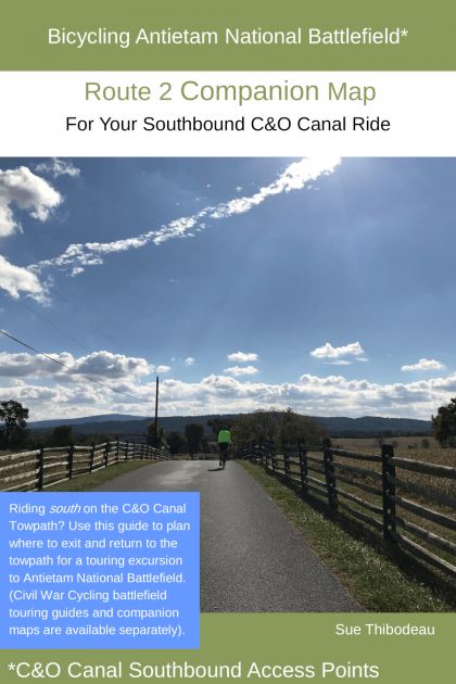
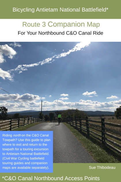
Routes 2 and 3 provide instructions for exiting and returning to the C&O Canal Towpath.
The Route 1 Companion Map is a 34-page full color, printable PDF map with photos, bicycling cues, and tips for a 9.2-mile historical tour. It covers these Antietam battlefield sites: North Woods, East and West Woods, The Cornfield, Dunker Church, The Bloody Lane, and Burnside Bridge. It also includes short histories of all Maryland regimental monuments and four high-level military maps that help you to understand battlefield events at each of four touring segments. Plan for 3-4 hours, including lengthy stops and breaks.
Southbound to Antietam Battlefield
Will you be riding south on the C & O Canal Towpath to Antietam National Battlefield? The Route 2 Companion Map is your guide for a touring excursion through Antietam National Battlefield. This is a 30-page full color, printable PDF map set. It includes photos, GPS coordinates, elevation data, road descriptions, and bicycling cues and tips for exiting and returning to the towpath.
Northbound to Antietam Battlefield
Will you be riding north on the C & O Canal Towpath to Antietam National Battlefield? This guide is similar to the the southbound guide, but the recommended canal towpath exit and return points are slightly different.
Enjoy your maps (no license keys)
Ready to purchase and download your maps? Although PayPal manages the checkout process, you do not need a PayPal account, only a debit or credit card. Of course, the transaction is secure. After you authorize payment, you will be sent an email with a download link to your PDF map.
You can print Civil War Cycling’s PDF for your personal use without having to hassle with license keys or any kind of “digital rights management.”
Most bicyclists will print maps for bicycling Antietam and then stuff them into jersey pockets, panniers, or handlebar map bags for use during a bicycle ride. You can also read the PDF file on your mobile device (if you have a PDF reader) during a battlefield stop. For safety reasons, Civil War Cycling’s maps are not designed for use while riding your bicycle.
Sometime during a routine Civil War Cycling website upgrade, “photo galleries” stopped rendering nicely. You would have noticed warped or overlapping images while browsing with a mobile device.
The following pages have been repaired.
Grouped thematically, these photos will help you to plan an educational bike tour.
Also, please note that you may need to force your browser to refresh each page. (Try Ctrl-F5 from a Windows desktop computer).
Also, please note that Civil War Cycling’s Shop is now stocked with digital maps for bicycling Gettysburg National Military Park. That means that it’s not too early to plan your 2019 ride. Just in time for the holiday season.
Hopefully, our performance boost will help you to find the Gettysburg bike maps that you have been looking for.
But first, a question about Gettysburg bike maps and cycling loops…
View of Hancock Avenue looking north toward the Pennsylvania State Monument
Hancock Avenue is one-way heading north. Knowing that, can you complete a cycling loop? In other words, do you think it’s enough to have a free park map? Or do you need a pre-defined bike route through the park that completes a loop?
ON SALE – Download your Gettysburg bike maps today.
Civil War Cycling’s Shop is now stocked with Gettysburg bike maps. Available for immediate purchase and download. It’s not too early to plan your 2019 ride. In fact, your might be just in time for the holiday season.
Civil War Cycling got another performance boost! There is a ton of historical and bicycling information available on our website, so we want our pages to run snappy. Today, we completed Phase II improvements that you will notice almost immediately. If your primary interest is Gettysburg National Military Park, checkout these links to pages with tons of photos:
Landscape Photos of Barlow’s Knoll, Cemetery Ridge, Culp’s Hill, Devil’s Den, East Cavalry Field, East Cemetery Hill, Little Round Top, Oak Hill, McPherson Ridge, The Peach Orchard, Rose Woods, Seminary Ridge, the town of Gettysburg, and The Wheatfield.
Monument Gallery, including thematic presentations, by category, including USA State Monuments, CSA State Monuments, Equestrian Monuments, and more.